info@shustrik-maps.com

Contact me


    Free conversion to OBJ/FBX/STL/C4D
    • Services
    • About
    • FAQ
    • Site Map
    • How to buy?
    info@shustrik-maps.com

    Contact me


      Logo shustrik maps
      • 3D MODELSOBJ/FBX/C4D
        • Solar System

          3D MODELS OF SOLAR SYSTEM OBJECTS

          Planets (11)

          11 products

          Satellites (1)

          1 product

          Space objects (3)

          3 products
        • World

          World (8)

          8 products

          North Pole (1)

          1 product

          South Pole (1)

          1 product

          Fantasy (2)

          2 products
        • Continents

          North America (2)

          2 products

          South America (2)

          2 products

          Europe (2)

          2 products

          Asia (1)

          1 product

          Africa (2)

          2 products

          Oceania (3)

          3 products

          Antarctica (1)

          1 product
        • Peninsulas

          Peninsulas (1)

          1 product
        • Islands

          Islands (13)

          13 products
        • Countries

          All countries →

          3D MODELS OF THE COUNTRIES

          A | B | C | D | E | 

          F | G | H | I | J | 

          K | L | M | N | O | 

          P | Q | R | S | T | 

          U | V | W | Y | Z | 

          3D MODELS OF COUNTRIES BY CONTINENT

          NORTH AMERICA

          • Northern America
          • Central America
          • Caribbean

          SOUTH AMERICA

          EUROPE

          • Western Europe
          • Northern Europe
          • Southern Europe
          • Eastern Europe

          AFRICA

          • Eastern Africa
          • Middle Africa
          • Northern Africa
          • Southern Africa
          • Western Africa

          ASIA

          • Central Asia
          • Eastern Asia
          • Southeast Asia
          • Southern Asia
          • Western Asia
        • States of America

          All states →

          UNITED STATES 3D MODELS

          Alabama

          • C4D/OBJ/BLEND 
          • STL
          • Satellite Map

          Alaska

          • STL


          Arizona

          • C4D/OBJ/BLEND 
          • STL
          • Satellite Map

          Arkansas

          • C4D/OBJ/BLEND 
          • STL
          • Satellite Map

          California

          • Tex 1: C4D/OBJ
          • Tex 2: C4D/OBJ
          • STL
          • Satellite Map

          Colorado

          • C4D/OBJ/BLEND
          • STL
          • Satellite Map

          Connecticut

          • STL
          • Satellite Map

          Delaware

          • STL
          • Satellite Map

          Florida

          • C4D/OBJ/BLEND
          • STL
          • Satellite Map

          Georgia

          • STL
          • Satellite Map

          Hawaii

          • C4D/OBJ/BLEND
          • STL


          Idaho

          • C4D/OBJ/BLEND
          • STL
          • Satellite Map

          Illinois

          • STL
          • Satellite Map

          Indiana

          • C4D/OBJ/BLEND
          • STL
          • Satellite Map

          Iowa

          • C4D/OBJ/BLEND
          • STL
          • Satellite Map

          Kansas

          • C4D/OBJ/BLEND
          • STL
          • Satellite Map

          Kentucky

          • STL
          • Satellite Map

          Louisiana

          • STL
          • Satellite Map

          Maine

          • STL
          • Satellite Map

          Maryland

          • STL
          • Satellite Map

          Massachusetts

          • STL
          • Satellite Map

          Michigan

          • STL

          Minnesota

          • STL


          Mississippi

          • STL

          Missouri

          • STL

          Montana

          • Tex 1: C4D/OBJ
          • Tex 1: C4D/OBJ
          • STL

          Nebraska

          • C4D/OBJ/BLEND
          • STL


          Nevada

          • C4D/OBJ/BLEND
          • STL


          New Hampshire

          • STL


          New Jersey

          • STL

          New Mexico

          • C4D/OBJ/BLEND
          • STL

          New York

          • STL


          North Carolina

          • STL

          North Dakota

          • C4D/OBJ/BLEND
          • STL

          Ohio

          • STL


          Oklahoma

          • STL

          Oregon

          • C4D/OBJ/BLEND
          • STL

          Pennsylvania

          • STL


          Rhode Island

          • STL

          South Carolina

          • STL

          South Dakota

          • C4D/OBJ/BLEND
          • STL

          Tennessee

          • STL


          Texas

          • C4D/OBJ/BLEND
          • STL

          Utah

          • C4D/OBJ/BLEND
          • STL


          Vermont

          • STL


          Virginia

          • STL

          Washington

          • C4D/OBJ/BLEND
          • STL

          West Virginia

          • STL


          Wisconsin

          • STL

          Wyoming

          • C4D/OBJ/BLEND
          • STL
        • Canadian Provinces

          CANADIAN PROVINCES 3D MODELS

          Alberta

          British Columbia

          Manitoba

          New Brunswick

          Newfoundland

          Nova Scotia

          Ontario

          Prince Edward

          Quebec

          Saskatchewan

          CANADIAN TERRITORIES 3D MODELS

          Northwest Territories

          Nunavut

          Yukon

        • Parks & Canyons

          3D MODELS OF NATIONAL PARKS AND CANYONS

          Canyons (2)

          2 products
        • Other

          ART (4)

          4 products
      • 3D PRINT/CNC MODELSSTL
        • Planets
        • Satellites
        • Continents
        • Countries
        • Islands
        • States of America
        • Fantasy
        • Other
      • MAPSTIF/PSD/SVG
        • Satellite Maps
        • Night Satellite Map
        • Heightmaps/Raster DEM
        • Relief Maps
        • 3D Maps
        • Historical Maps
        • Outline Maps
      • FREE
      • SERVICES
      • A-Z
      Search
      0 items / $0.00
      Menu
      3D Models and 3D Maps
      0 items / $0.00
      New
      High-resolution flat projection of the AuthaGraph world map
      AuthaGraph map formatted for poster printing and framing
      Close-up showing spatial accuracy of the AuthaGraph projection
      AuthaGraph Map OSM
      Large-format printed version of the AuthaGraph map as wall art
      The map being used in a classroom for teaching geography
      Visual showing true proportions of continents on the map
      high resolution authagraph world map
      full size authagraph world map
      world map authagraph
      authagraph map of the world
      authagraph world map
      AuthaGraph Map
      Use of AuthaGraph map in modern digital graphic design
      Click to enlarge
      High-resolution flat projection of the AuthaGraph world map
      AuthaGraph map formatted for poster printing and framing
      Close-up showing spatial accuracy of the AuthaGraph projection
      AuthaGraph Map OSM
      Large-format printed version of the AuthaGraph map as wall art
      The map being used in a classroom for teaching geography
      Visual showing true proportions of continents on the map
      high resolution authagraph world map
      full size authagraph world map
      world map authagraph
      authagraph map of the world
      authagraph world map
      AuthaGraph Map
      Use of AuthaGraph map in modern digital graphic design
      Home MAPS Satellite Maps World Authagraph World Map
      3D projection of the AuthaGraph map showing accurate global distribution
      Authagraph World Map – 3D Model $150.00
      Back to products
      Overview of Denmark Terrain 3D Model featuring elevation and topography
      Denmark Terrain 3D Model $35.00

      Authagraph World Map

      $50.00

      • Format: TIF/ PSD (to create the mosaic)
      • Files size (unzipped): 1.2 GB (3 textures)
      • Resolution: 24000*10392*32b
      • Projection: AuthaGraph

      We accept VISA, Mastercard, ApplePay, GooglePay and other payment methods

      — OR —

      You can also purchase this product using MasterCard/Visa on
      RenderHub →  and 3Dexport →.

      SKU: SH_3642 Categories: MAPS, Satellite Maps, World Tags: AuthaGraph, PSD, TIF
      Share:
      • Description
      Description

      High-Resolution AuthaGraph World Map – Seamless Flat Projection

      Explore a new dimension of global understanding with our High-Resolution AuthaGraph World Map. This scientifically accurate flat map projection minimizes landmass distortion and enables seamless tiling for custom map creation.

      What is the AuthaGraph World Map?

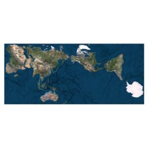
      The AuthaGraph map of the world is a cutting-edge innovation in cartography. It provides a flat map projection of the Earth that preserves spatial accuracy better than traditional maps like Mercator or Robinson.

      This unique design allows for creating custom global representations, including triangular and rectangular mosaics with flexible region focus — Asia, Europe, the Pacific, and more.

      Multiple AuthaGraph maps tiled together to form a new layout

      Key Features of the AuthaGraph Flat Map

      Ultra High-Resolution Output

      This high resolution AuthaGraph world map is perfect for large-scale print, detailed zooms, and digital interfaces. Ideal for educational, artistic, and interactive applications.

      Seamless Tiling and Mosaic Creation

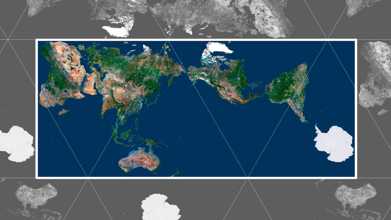
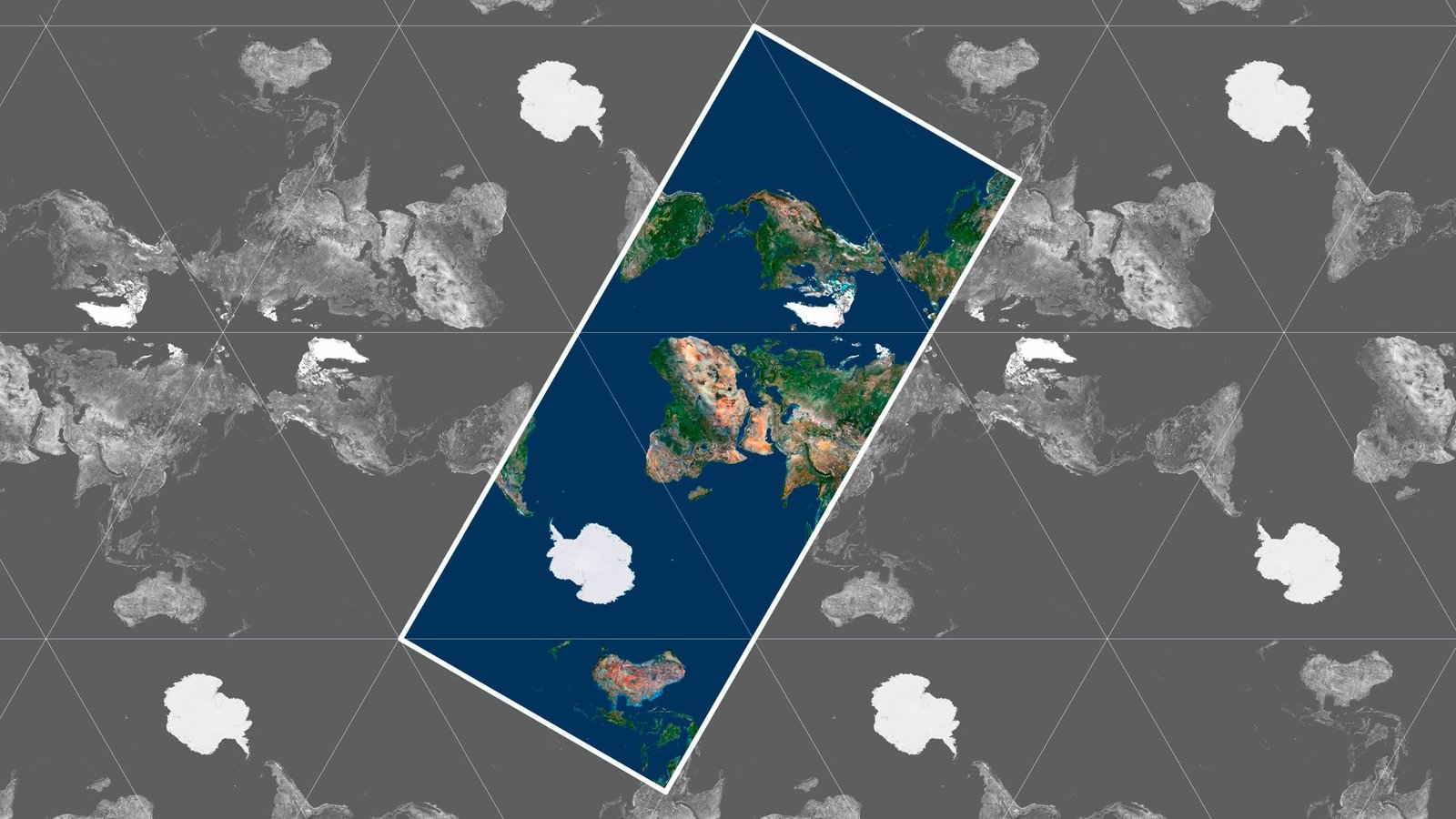
      The map’s geometry allows users to tile multiple copies together without visible seams. This feature is especially useful for creating custom world maps with varied centers, highlighting specific geographies or global perspectives.

      For Designers, Educators & Cartographers

      Whether you’re working in graphic design, educational media, or building interactive map tools, this AuthaGraph world map poster is ready to deliver precision and visual elegance.


      Applications and Use Cases

      • Print Design: Posters, wall art, and infographics

      • Educational Tools: Teaching geography with spatial accuracy

      • Interactive Maps: Web-based geography apps and data visualization

      • Custom Global Layouts: Create new worldviews by reshaping the mosaic

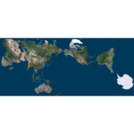
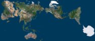
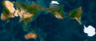
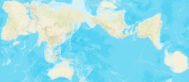
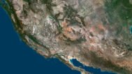
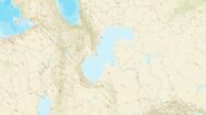
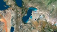
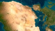
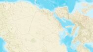
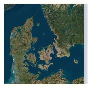
      Source map in AuthaGraph projection

      Modified rectangular layout of the AuthaGraph world map

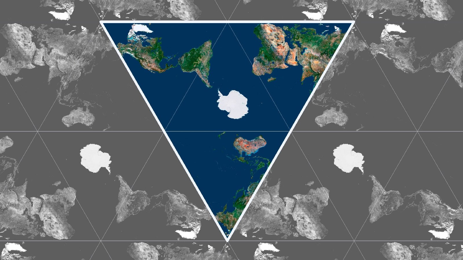
      Triangular map with Antarctica in the center (example)

      Creative triangular layout using seamless AuthaGraph tiles

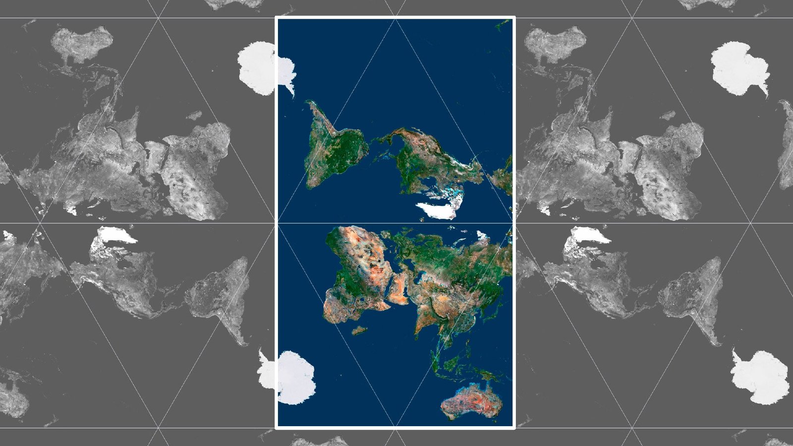
      Map with the North Pole in the center (example)

      AuthaGraph Map in Graphic Design

      A map with Africa in the center (example)

      Seamless Tiled AuthaGraph Mosaic

      Color Map with Borders (example)

      Color Map with Borders (example)

      Have a Question?

      Do you need an ultra-high resolution AuthaGraph world map?
      Do you need different projections?
      Do you need different world textures?
      WRITE A MESSAGE
      Authagraph World Map – 3D Model

      Related products

      India 3D map
      Satellite map of India

      India 3d map

      $32.00
      Add to cart
      Map of Switzerland 1892
      Switzerland relief map

      Map of Switzerland 1892

      Read more

      Physical features of the United States

      Read more
      Relief map of Afghanistan
      Afghanistan maps 3d

      Relief map of Afghanistan

      Read more
      Austria maps 3d
      Relief map Austria

      Relief map of Austria

      Read more
      Relief map of Germany
      Germany relief map

      Relief map of Germany

      Read more

      Relief map of Greece

      Read more
      Italy relief
      Topographic map Italy

      Relief map of Italy

      $15.00
      Add to cart
      Relief map of Japan
      Japan maps 3d

      Relief map of Japan

      Read more
      Relief map of Taiwan
      mapa 3d Taiwan

      Relief map of Taiwan

      Read more
        INFO
        • About
        • Explore Our Terrain Services
        • Support
        • Shipping and delivery policy
        • Refund and Returns Policy
        • Privacy Policy
        • in**@***********ps.com
        • Blog
        How to buy
        • TERRAIN 3D MODELS FREE
        • Purchase with Crypto/PayPal/VISA
        • Buy on Cults3D.com
        • Buy on CGtrader.com
        • Buy on RenderHub.com
        • Buy on 3DExport.com
        • Discounts
        Buy 3D models
        • Planets
        • World
        • Continents
        • Peninsulas
        • Islands
        • Countries
        • States of America
        • Canadian Provinces
        • Canyons
        • Cities
        • Fantasy
        • Minecraft
        Buy 3D models for CNC
        • Planets
        • Continents
        • Islands
        • Countries
        • States of America

        DEM DSM DTM FBX OBJ STL

        SHUSTRIK-MAPS 2025
        • 3D MODELS
        • 3D PRINT/CNC MODELS
        • MAPS
        • FREE
        • About
        • FAQ
        • How to buy?
        • Site Map HTML
        • Explore Our Terrain Services
        Shopping cart
        Close
        Start typing to see products you are looking for.
        Your amount to pay has been updated
        The previous conversion quote has expired. Here is your new quote:
        Total
        $
        You Pay
        Back to checkout
        Place Order