Idaho Topographic Map STL – 3D Terrain Model for 3D Printing & CNC
Original price was: $21.00.$15.00Current price is: $15.00.
![]()
- File size: 316 MB
- Model size: 200 mm x 172.7606 mm x 3.649 mm
- Projection: Mercator
- Scaling factor: X — 1; Y — 1; Z — 3
- Polygons: 6 643 412
- Vertices: 3 321 708
- Geometry: Polygonal Tris only
- Base: Closed
Idaho Topographic Map STL – High-Resolution 3D Terrain Model
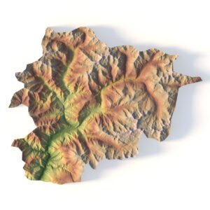
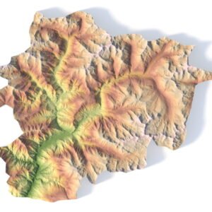
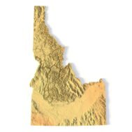
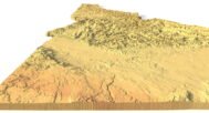
Idaho Topographic Map STL is a high-detail 3D terrain model generated from accurate elevation data and optimized for 3D printing, CNC carving, and laser engraving. The model precisely represents Idaho’s diverse landscape, including mountain ranges, river valleys, plateaus, and rugged highlands, making it ideal for professional, educational, and creative applications.
This Idaho terrain STL model is delivered in standard STL format and is fully compatible with FDM and SLA 3D printers, as well as CNC routers and milling machines. Enhanced vertical scaling ensures strong depth perception and clear terrain readability, allowing Idaho’s pronounced elevation changes to be accurately reproduced in physical relief maps.
Key Features of the Idaho Terrain STL Model
- High-detail Idaho topographic map STL
- Accurate digital elevation model (DEM)
- Optimized for 3D printing (FDM / SLA)
- Ready for CNC carving and milling
- Suitable for laser engraving
- Mercator projection for consistent geometry
- Triangle-only polygonal mesh
- Open or closed base configuration
Applications of the Idaho 3D Topographic Map
This Idaho 3D terrain model supports a wide range of use cases:
- Raised topographic relief maps
- CNC-carved wooden or metal terrain models
- Educational geography and geology projects
- Landscape and terrain visualization
- Hydrological and watershed studies
- Museum exhibits and presentation displays
- Decorative wall maps and custom interior elements
Whether you are producing a 3D printed Idaho map, a CNC terrain model, or a laser-engraved relief, this STL file delivers professional-grade accuracy and reliable manufacturing results.