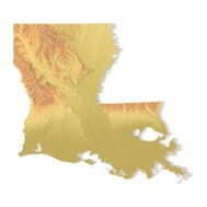


Louisiana Topographic Map STL – 3D Terrain Model for 3D Printing & CNC
Original price was: $21.00.$15.00Current price is: $15.00.
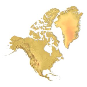
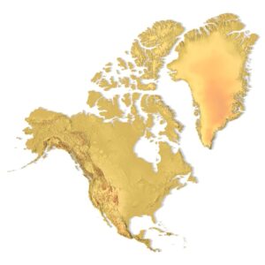
![]()
- File size: 204 MB
- Model size: 141.1905 mm x 200 mm x 1.5 mm
- Projection: Mercator
- Scaling factor: X — 1; Y — 1; Z — 3
- Polygons: 1 480 304
- Vertices: 741 628
- Geometry: Polygonal Tris only
- Base: Closed
Louisiana Topographic Map STL – High-Detail 3D Terrain Model
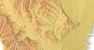
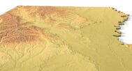
Louisiana Topographic Map STL is a high-resolution 3D terrain model based on accurate elevation data, created for 3D printing, CNC carving, and laser engraving. The model precisely represents Louisiana’s unique low-relief landscape, including river floodplains, coastal areas, wetlands, deltas, and subtle elevation changes shaped by the Mississippi River system.
Delivered in STL format, this Louisiana terrain model is fully compatible with FDM and SLA 3D printers, as well as CNC routers and milling machines. Optimized polygonal geometry combined with enhanced vertical scaling ensures that even minimal height variations are clearly visible in physical relief maps.
Key Features of the Louisiana Terrain STL Model
- High-detail Louisiana topographic map STL
- Accurate digital elevation model (DEM)
- Optimized for low-relief terrain representation
- Suitable for 3D printing (FDM / SLA)
- Compatible with CNC carving and milling
- Ready for laser engraving
- Mercator projection for consistent geometry
- Triangle-only polygonal mesh
- Open or closed base option
Applications of the Louisiana 3D Topographic Map
This Louisiana 3D terrain model is ideal for a wide range of applications:
- Raised topographic relief maps
- CNC-carved wooden or metal terrain models
- Educational geography and environmental studies
- Hydrology and river-system visualization
- Museum exhibits and presentation models
- Decorative wall maps and custom installations
Whether you are producing a 3D printed Louisiana map, a CNC terrain model, or a laser-engraved relief, this STL file provides clear elevation representation and professional-grade accuracy.