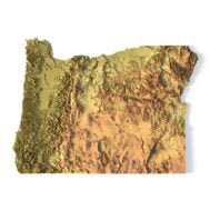
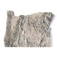
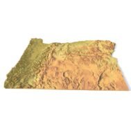
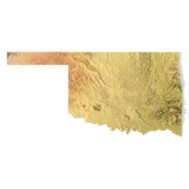
State of Oregon STL model
$21.00
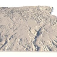
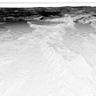
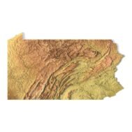
High-polygon 3D model state of Oregon in STL format
![]()
- File size: 737 MB
- Model size: 360.7 mm x 265.5 mm x 4.205 mm
- Resolution: 0,1 mm
- Projection: Mercator
- Scaling factor: X — 1; Y — 1; Z — 3
- Polygons: 15 475 288
- Vertices: 7 747 036
- Geometry: Polygonal Tris only
- Base: Open
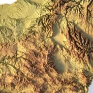
Oregon is a state in the Pacific Northwest region of the Western United States. The Columbia River delineates much of Oregon’s northern boundary with Washington, while the Snake River delineates much of its eastern boundary with Idaho. The 42° north parallel delineates the southern boundary with California and Nevada.
Oregon’s highest point is the summit of Mount Hood, at 11,249 feet (3,429 m), and its lowest point is the sea level of the Pacific Ocean along the Oregon Coast. Oregon’s mean elevation is 3,300 feet (1,006 m). Crater Lake National Park, the state’s only national park, is the site of the deepest lake in the United States at 1,943 feet (592 m).
Oregon lies in two time zones. Most of Malheur County is in the Mountain Time Zone, while the rest of the state lies in the Pacific Time Zone.
What can I use a 3D model in STL format for?
STL model state of Oregon can be used for various purposes:
- Making physical models from plastic or photopolymer using 3D printers
- Making models of wood or metal using CNC machines
- Making a high-resolution relief using 3D laser markers
- Making of “master forms” for duplication of products using foam polystyrene or concrete
- Creating computer graphics
- Creation of low-polygonal models for computer games


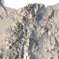
What is the resolution of the 3D model state of Oregon?
With the development of technology, it is becoming possible to produce more and more precise relief models.
For example, there are 3D printers that can print models with a layer height of 0.16 mm, 0.1 mm, 0.05 mm, or even less. These devices require high-quality models. But a higher-quality 3D model contains more polygons and has a larger file size. One of the challenges is to find a compromise between the file size of the STL model, which would be convenient to work with, and the desired quality of the finished product.
The 3D model state of Oregon has a fairly large size and many polygons.

How do I change the parameters of the STL model state of Oregon?
You can easily resize the model in any program that allows you to import STL files.
In addition to changing the scale in width, length, and height, you can add a higher base. You can also use anti-aliasing tools, add bulk text, reduce the number of polygons, etc.