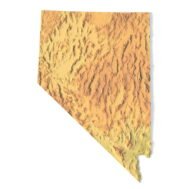
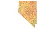
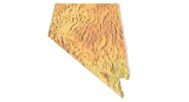
Nevada Topographic Map STL – 3D Terrain Model for 3D Printing & CNC
Original price was: $21.00.$15.00Current price is: $15.00.
![]()
- File size: 170 MB
- Model size: 200.0001 mm x 173.261 mm x 2.5 mm
- Projection: Lambert conformal conic
- Scaling factor: X — 1; Y — 1; Z — 3
- Polygons: 3 578 674
- Vertices: 1 789 339
- Geometry: Polygonal Tris only
- Base: Closed
Nevada Topographic Map STL – High-Resolution 3D Terrain Model
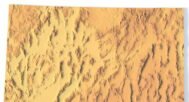
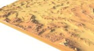
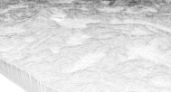
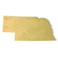
Nevada Topographic Map STL is a high-detail 3D terrain model created from accurate elevation data and optimized for 3D printing, CNC carving, and laser engraving. The model precisely represents Nevada’s dramatic and varied landscape, including mountain ranges, desert basins, valleys, plateaus, and rugged relief features characteristic of the Basin and Range Province.
Delivered in STL format, this Nevada terrain model is fully compatible with FDM and SLA 3D printers, as well as CNC routers and milling machines. Clean polygonal geometry combined with enhanced vertical scaling provides realistic terrain depth, sharp elevation transitions, and clear relief details in physical topographic maps.
Key Features of the Nevada Terrain STL Model
- High-detail Nevada topographic map STL
- Accurate digital elevation model (DEM)
- Suitable for 3D printing (FDM / SLA)
- Compatible with CNC carving and milling
- Optimized for laser engraving
- Mercator projection for consistent proportions
- Triangle-only polygonal mesh
- Open or closed base option
Applications of the Nevada 3D Topographic Map
This Nevada 3D terrain model is suitable for a wide range of applications:
- Raised topographic relief maps
- CNC-carved wooden or metal terrain models
- Educational geography and geology projects
- Desert and mountain landscape visualization
- Museum exhibits and presentation models
- Decorative wall maps and custom installations
Whether you are producing a 3D printed Nevada map, a CNC terrain model, or a laser-engraved relief, this STL file delivers professional-grade accuracy and reliable manufacturing results.