info@shustrik-maps.com

Contact me


    Free conversion to OBJ/FBX/STL/C4D
    • Services
    • About
    • FAQ
    • Site Map
    • How to buy?
    info@shustrik-maps.com

    Contact me


      Logo shustrik maps
      • 3D MODELSOBJ/FBX/C4D
        • Solar System

          3D MODELS OF SOLAR SYSTEM OBJECTS

          Planets (11)

          11 products

          Satellites (1)

          1 product

          Space objects (3)

          3 products
        • World

          World (8)

          8 products

          North Pole (1)

          1 product

          South Pole (1)

          1 product

          Fantasy (2)

          2 products
        • Continents

          North America (2)

          2 products

          South America (2)

          2 products

          Europe (2)

          2 products

          Asia (1)

          1 product

          Africa (2)

          2 products

          Oceania (3)

          3 products

          Antarctica (1)

          1 product
        • Peninsulas

          Peninsulas (1)

          1 product
        • Islands

          Islands (13)

          13 products
        • Countries

          All countries →

          3D MODELS OF THE COUNTRIES

          A | B | C | D | E | 

          F | G | H | I | J | 

          K | L | M | N | O | 

          P | Q | R | S | T | 

          U | V | W | Y | Z | 

          3D MODELS OF COUNTRIES BY CONTINENT

          NORTH AMERICA

          • Northern America
          • Central America
          • Caribbean

          SOUTH AMERICA

          EUROPE

          • Western Europe
          • Northern Europe
          • Southern Europe
          • Eastern Europe

          AFRICA

          • Eastern Africa
          • Middle Africa
          • Northern Africa
          • Southern Africa
          • Western Africa

          ASIA

          • Central Asia
          • Eastern Asia
          • Southeast Asia
          • Southern Asia
          • Western Asia
        • States of America

          All states →

          UNITED STATES 3D MODELS

          Alabama

          • C4D/OBJ/BLEND 
          • STL
          • Satellite Map

          Alaska

          • STL


          Arizona

          • C4D/OBJ/BLEND 
          • STL
          • Satellite Map

          Arkansas

          • C4D/OBJ/BLEND 
          • STL
          • Satellite Map

          California

          • Tex 1: C4D/OBJ
          • Tex 2: C4D/OBJ
          • STL
          • Satellite Map

          Colorado

          • C4D/OBJ/BLEND
          • STL
          • Satellite Map

          Connecticut

          • STL
          • Satellite Map

          Delaware

          • STL
          • Satellite Map

          Florida

          • C4D/OBJ/BLEND
          • STL
          • Satellite Map

          Georgia

          • STL
          • Satellite Map

          Hawaii

          • C4D/OBJ/BLEND
          • STL


          Idaho

          • C4D/OBJ/BLEND
          • STL
          • Satellite Map

          Illinois

          • STL
          • Satellite Map

          Indiana

          • C4D/OBJ/BLEND
          • STL
          • Satellite Map

          Iowa

          • C4D/OBJ/BLEND
          • STL
          • Satellite Map

          Kansas

          • C4D/OBJ/BLEND
          • STL
          • Satellite Map

          Kentucky

          • STL
          • Satellite Map

          Louisiana

          • STL
          • Satellite Map

          Maine

          • STL
          • Satellite Map

          Maryland

          • STL
          • Satellite Map

          Massachusetts

          • STL
          • Satellite Map

          Michigan

          • STL

          Minnesota

          • STL


          Mississippi

          • STL

          Missouri

          • STL

          Montana

          • Tex 1: C4D/OBJ
          • Tex 1: C4D/OBJ
          • STL

          Nebraska

          • C4D/OBJ/BLEND
          • STL


          Nevada

          • C4D/OBJ/BLEND
          • STL


          New Hampshire

          • STL


          New Jersey

          • STL

          New Mexico

          • C4D/OBJ/BLEND
          • STL

          New York

          • STL


          North Carolina

          • STL

          North Dakota

          • C4D/OBJ/BLEND
          • STL

          Ohio

          • STL


          Oklahoma

          • STL

          Oregon

          • C4D/OBJ/BLEND
          • STL

          Pennsylvania

          • STL


          Rhode Island

          • STL

          South Carolina

          • STL

          South Dakota

          • C4D/OBJ/BLEND
          • STL

          Tennessee

          • STL


          Texas

          • C4D/OBJ/BLEND
          • STL

          Utah

          • C4D/OBJ/BLEND
          • STL


          Vermont

          • STL


          Virginia

          • STL

          Washington

          • C4D/OBJ/BLEND
          • STL

          West Virginia

          • STL


          Wisconsin

          • STL

          Wyoming

          • C4D/OBJ/BLEND
          • STL
        • Canadian Provinces

          CANADIAN PROVINCES 3D MODELS

          Alberta

          British Columbia

          Manitoba

          New Brunswick

          Newfoundland

          Nova Scotia

          Ontario

          Prince Edward

          Quebec

          Saskatchewan

          CANADIAN TERRITORIES 3D MODELS

          Northwest Territories

          Nunavut

          Yukon

        • Parks & Canyons

          3D MODELS OF NATIONAL PARKS AND CANYONS

          Canyons (2)

          2 products
        • Other

          ART (6)

          6 products
      • 3D PRINT/CNC MODELSSTL
        • Planets
        • Satellites
        • Continents
        • Countries
        • Islands
        • States of America
        • Fantasy
        • Other
      • MAPSTIF/PSD/SVG
        • Satellite Maps
        • Night Satellite Map
        • Heightmaps/Raster DEM
        • Relief Maps
        • 3D Maps
        • Historical Maps
        • Outline Maps
      • FREE
      • SERVICES
      • A-Z
      Search
      0 items / $0.00
      Menu
      3D Models and 3D Maps
      0 items / $0.00
      -19%
      Italy STL model
      Italy 3D model
      Italy buy 3d models
      Italy 3D map
      3D STL model of Italy’s topography, showcasing detailed elevation data and landforms, ideal for terrain visualization and 3D printing.
      A detailed topographic map of Italy designed for CNC machining, perfect for creating relief models in wood or metal.
      Digital elevation model of Italy, displaying accurate topographical features for surface mapping and geospatial analysis.
      Click to enlarge
      Italy STL model
      Italy 3D model
      Italy buy 3d models
      Italy 3D map
      3D STL model of Italy’s topography, showcasing detailed elevation data and landforms, ideal for terrain visualization and 3D printing.
      A detailed topographic map of Italy designed for CNC machining, perfect for creating relief models in wood or metal.
      Digital elevation model of Italy, displaying accurate topographical features for surface mapping and geospatial analysis.
      Home 3D PRINT/CNC MODELS Countries Italy Topographic Map STL Model
      Germany STL model
      Germany STL model $21.00 Original price was: $21.00.$17.00Current price is: $17.00.
      Back to products
      3D terrain model of Mexico in STL format, front view
      Mexico Topographic Map – 3D Model for 3D Printing & CNC Carving $15.00

      Italy Topographic Map STL Model

      $21.00 Original price was: $21.00.$17.00Current price is: $17.00.

      Italy Topographic Map STL Model for 3D Printing and CNC Machining

      • Files size: 738 MB (ZIP 221 MB) – with Base 5 mm and without Base
      • Polygons: 12 468 202
      • Vertices: 6 258 883
      • Geometry: Polygonal Tris only
      • Model size: 132.3 mm x 171.9 mm x 1.408 mm
      • Projection: Mercator
      • Scaling factor X:Y:Z: 1:1:3
      • Base: Clsed

      We accept VISA, Mastercard, ApplePay, GooglePay and other payment methods

      — OR —

      You can also purchase this product using MasterCard/Visa on
      RenderHub →  and 3Dexport →.

      SKU: SH_7317 Category: Countries Tags: Countries, I, Mercator, Southern Europe, STL
      Share:
      • Description
      Description

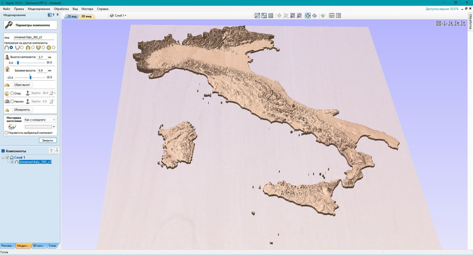
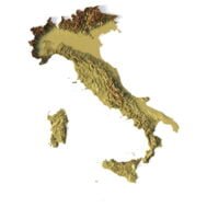
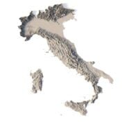
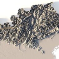
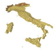
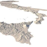
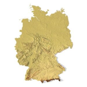
      Explore the detailed landscapes of Italy with our Italy Topographic Map STL model, designed for terrain analysis, surface mapping, and landform representation. This high-resolution 3D model captures Italy’s unique topography, making it perfect for educational, design, and cartographic projects.

      Applications of the Italy Topographic STL Model

      • 3D Printing: Use the model to create physical representations of Italy’s topography with FDM or SLA printers, producing accurate terrain maps in plastic or photopolymer.
      • CNC Machining: Ideal for wood and metal CNC machining, the model offers precise landform representation of Italy’s diverse geography.
      • Laser Engraving: Perfect for high-precision laser engraving on metal surfaces using 3D laser markers, showcasing Italy’s digital elevation model in fine detail.

      High-Resolution Terrain Analysis and Geographic Study

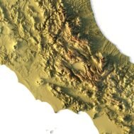
      This Italy topographic map is equipped with accurate geospatial data and physical geography details, making it an essential tool for researchers, educators, and designers interested in Italy’s natural terrain. From the Alps to the coastal plains, every element of the terrain is captured with precision.

      Why Choose Our Italy Topographic Map STL Model?

      • Accurate Topography: The model provides detailed elevation and surface mapping data for accurate cartography and geographic information system (GIS) projects.
      • Multi-Purpose: Suitable for 3D printing, CNC machining, and laser engraving, offering versatility across a wide range of industries.
      • Customizable: Easily modify the STL file for your specific project, whether it’s for educational displays, geographic research, or personalized design work.

      Bring Italy’s landscapes to life with our Italy Topographic Map STL Model. Download now and start creating detailed, accurate physical models of Italy’s terrain.

      Wooden 3D map
      Terrain 3D print
      3D map of wood
      3D natural wood map
      3D metal map

        What is the resolution of the 3D model of Italy?

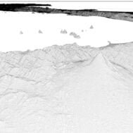
        With the development of technology, it is becoming possible to produce more and more precise relief models.

        For example, there are 3D printers that can print models with a layer height of 0.16 mm, 0.1 mm, 0.05 mm, or even less. These devices require high-quality models. But a higher-quality 3D model contains more polygons and has a larger file size. One of the challenges is to find a compromise between the file size of the STL model, which would be convenient to work with, and the desired quality of the finished product.

        The 3D model of Italy has a fairly large size and many polygons.

        Distance between neighboring points of one polygon in one plane is R ~ 0.03 mm for the specified size of the model. Therefore, such model is suitable for high-precision printing.

        How do I change the parameters of the STL model of Italy?

        You can easily resize the model in any program that allows you to import STL files.

        In addition to changing the scale in width, length, and height, you can add a higher base. You can also use anti-aliasing tools, add bulk text, reduce the number of polygons, etc.

        Leave a request if you need a model of Italy in other sizes, resolutions or projections.

        Italy’s topography visualized for precision laser engraving, showcasing elevation and surface details for high-quality engraving projects.
        3D model of Italy relief
        Relief map of Italy
        Italy hydrographic and orografic map 1853
        Italy 3D Model Terrain
        Italy Satellite Map

        Related products

        Albania Topographic Map – 3D Model for 3D Printing & CNC Carving

        $15.00
        Add to cart
        Full 3D STL model of Azerbaijan showing terrain detail
        Azerbaijan elevation STL with detailed contour lines

        Azerbaijan Topographic Map – 3D Model for 3D Printing & CNC Carving

        $15.00
        Add to cart
        3D terrain model of Bangladesh in STL format, front view
        Close-up of Bangladesh’s river deltas in STL model

        Bangladesh Topographic Map – 3D Model for 3D Printing & CNC Carving

        $15.00
        Add to cart
        -19%
        Dominica STL model
        Dominica 3D model

        Dominica STL model

        $21.00 Original price was: $21.00.$17.00Current price is: $17.00.
        Add to cart
        -19%
        Ireland STL model
        Ireland 3D model

        Ireland STL model

        $21.00 Original price was: $21.00.$17.00Current price is: $17.00.
        Add to cart
        3D terrain model of Jamaica in STL format, front view

        Jamaica Topographic Map – 3D Model for 3D Printing & CNC Carving

        $15.00
        Add to cart
        3D terrain model of Kyrgyzstan in STL format, front view
        STL file of Kyrgyzstan map for CNC and 3D printing

        Kyrgyzstan Topographic Map – 3D Model for 3D Printing & CNC Carving

        $15.00
        Add to cart
        -19%
        Liberia STL model
        Liberia 3D model

        Liberia STL model

        $21.00 Original price was: $21.00.$17.00Current price is: $17.00.
        Add to cart
        3D terrain model of Turkey in STL format, front view
        STL file of Turkey map for CNC and 3D printing

        Turkey Topographic Map – 3D Model for 3D Printing & CNC Carving

        $15.00
        Add to cart
        3D terrain model of Ukraine in STL format, front view
        STL file of Ukraine map for CNC and 3D printing

        Ukraine Topographic Map – 3D Model for 3D Printing & CNC Carving

        $15.00
        Add to cart
          INFO
          • About
          • Explore Our Terrain Services
          • Support
          • Shipping and delivery policy
          • Refund and Returns Policy
          • Privacy Policy
          • in**@***********ps.com
          • Blog
          How to buy
          • TERRAIN 3D MODELS FREE
          • Purchase with Crypto/PayPal/VISA
          • Buy on Cults3D.com
          • Buy on CGtrader.com
          • Buy on RenderHub.com
          • Buy on 3DExport.com
          • Discounts
          Buy 3D models
          • Planets
          • World
          • Continents
          • Peninsulas
          • Islands
          • Countries
          • States of America
          • Canadian Provinces
          • Canyons
          • Cities
          • Fantasy
          • Minecraft
          Buy 3D models for CNC
          • Planets
          • Continents
          • Islands
          • Countries
          • States of America

          DEM DSM DTM FBX OBJ STL

          SHUSTRIK-MAPS 2025
          • 3D MODELS
            • Solar System
            • World
            • Continents
            • Peninsulas
            • Islands
            • Countries
            • States of America
            • Canadian Provinces
            • Canyons
            • Buildings
            • Fantasy
            • ART
          • 3D PRINT/CNC MODELS
            • Planets
            • Satellites
            • Continents
            • Countries
            • Islands
            • States of America
            • Fantasy
            • Other
          • MAPS
          • A-Z
          • FREE
          • About
          • FAQ
          • How to buy?
          • Site Map HTML
          • Explore Our Terrain Services
          Shopping cart
          Close
          Start typing to see products you are looking for.
          Your amount to pay has been updated
          The previous conversion quote has expired. Here is your new quote:
          Total
          $
          You Pay
          Back to checkout
          Place Order