info@shustrik-maps.com

Contact me


    Free conversion to OBJ/FBX/STL/C4D
    • Services
    • About
    • FAQ
    • Site Map
    • How to buy?
    info@shustrik-maps.com

    Contact me


      Logo shustrik maps
      • 3D MODELSOBJ/FBX/C4D
        • Solar System

          3D MODELS OF SOLAR SYSTEM OBJECTS

          Planets (11)

          11 products

          Satellites (1)

          1 product

          Space objects (3)

          3 products
        • World

          World (8)

          8 products

          North Pole (1)

          1 product

          South Pole (1)

          1 product

          Fantasy (2)

          2 products
        • Continents

          North America (2)

          2 products

          South America (2)

          2 products

          Europe (2)

          2 products

          Asia (1)

          1 product

          Africa (2)

          2 products

          Oceania (3)

          3 products

          Antarctica (1)

          1 product
        • Peninsulas

          Peninsulas (1)

          1 product
        • Islands

          Islands (13)

          13 products
        • Countries

          All countries →

          3D MODELS OF THE COUNTRIES

          A | B | C | D | E | 

          F | G | H | I | J | 

          K | L | M | N | O | 

          P | Q | R | S | T | 

          U | V | W | Y | Z | 

          3D MODELS OF COUNTRIES BY CONTINENT

          NORTH AMERICA

          • Northern America
          • Central America
          • Caribbean

          SOUTH AMERICA

          EUROPE

          • Western Europe
          • Northern Europe
          • Southern Europe
          • Eastern Europe

          AFRICA

          • Eastern Africa
          • Middle Africa
          • Northern Africa
          • Southern Africa
          • Western Africa

          ASIA

          • Central Asia
          • Eastern Asia
          • Southeast Asia
          • Southern Asia
          • Western Asia
        • States of America

          All states →

          UNITED STATES 3D MODELS

          Alabama

          • C4D/OBJ/BLEND 
          • STL
          • Satellite Map

          Alaska

          • STL


          Arizona

          • C4D/OBJ/BLEND 
          • STL
          • Satellite Map

          Arkansas

          • C4D/OBJ/BLEND 
          • STL
          • Satellite Map

          California

          • Tex 1: C4D/OBJ
          • Tex 2: C4D/OBJ
          • STL
          • Satellite Map

          Colorado

          • C4D/OBJ/BLEND
          • STL
          • Satellite Map

          Connecticut

          • STL
          • Satellite Map

          Delaware

          • STL
          • Satellite Map

          Florida

          • C4D/OBJ/BLEND
          • STL
          • Satellite Map

          Georgia

          • STL
          • Satellite Map

          Hawaii

          • C4D/OBJ/BLEND
          • STL


          Idaho

          • C4D/OBJ/BLEND
          • STL
          • Satellite Map

          Illinois

          • STL
          • Satellite Map

          Indiana

          • C4D/OBJ/BLEND
          • STL
          • Satellite Map

          Iowa

          • C4D/OBJ/BLEND
          • STL
          • Satellite Map

          Kansas

          • C4D/OBJ/BLEND
          • STL
          • Satellite Map

          Kentucky

          • STL
          • Satellite Map

          Louisiana

          • STL
          • Satellite Map

          Maine

          • STL
          • Satellite Map

          Maryland

          • STL
          • Satellite Map

          Massachusetts

          • STL
          • Satellite Map

          Michigan

          • STL

          Minnesota

          • STL


          Mississippi

          • STL

          Missouri

          • STL

          Montana

          • Tex 1: C4D/OBJ
          • Tex 1: C4D/OBJ
          • STL

          Nebraska

          • C4D/OBJ/BLEND
          • STL


          Nevada

          • C4D/OBJ/BLEND
          • STL


          New Hampshire

          • STL


          New Jersey

          • STL

          New Mexico

          • C4D/OBJ/BLEND
          • STL

          New York

          • STL


          North Carolina

          • STL

          North Dakota

          • C4D/OBJ/BLEND
          • STL

          Ohio

          • STL


          Oklahoma

          • STL

          Oregon

          • C4D/OBJ/BLEND
          • STL

          Pennsylvania

          • STL


          Rhode Island

          • STL

          South Carolina

          • STL

          South Dakota

          • C4D/OBJ/BLEND
          • STL

          Tennessee

          • STL


          Texas

          • C4D/OBJ/BLEND
          • STL

          Utah

          • C4D/OBJ/BLEND
          • STL


          Vermont

          • STL


          Virginia

          • STL

          Washington

          • C4D/OBJ/BLEND
          • STL

          West Virginia

          • STL


          Wisconsin

          • STL

          Wyoming

          • C4D/OBJ/BLEND
          • STL
        • Canadian Provinces

          CANADIAN PROVINCES 3D MODELS

          Alberta

          British Columbia

          Manitoba

          New Brunswick

          Newfoundland

          Nova Scotia

          Ontario

          Prince Edward

          Quebec

          Saskatchewan

          CANADIAN TERRITORIES 3D MODELS

          Northwest Territories

          Nunavut

          Yukon

        • Parks & Canyons

          3D MODELS OF NATIONAL PARKS AND CANYONS

          Canyons (2)

          2 products
        • Other

          ART (6)

          6 products
      • 3D PRINT/CNC MODELSSTL
        • Planets
        • Satellites
        • Continents
        • Countries
        • Islands
        • States of America
        • Fantasy
        • Other
      • MAPSTIF/PSD/SVG
        • Satellite Maps
        • Night Satellite Map
        • Heightmaps/Raster DEM
        • Relief Maps
        • 3D Maps
        • Historical Maps
        • Outline Maps
      • FREE
      • SERVICES
      • A-Z
      Search
      0 items / $0.00
      Menu
      3D Models and 3D Maps
      0 items / $0.00
      Spain Satellite Map
      High-resolution satellite map of Spain
      Downloadable satellite imagery of Spain
      Detailed aerial map of Spain
      Latest satellite images of Spain
      Spain landscape map
      Click to enlarge
      Spain Satellite Map
      High-resolution satellite map of Spain
      Downloadable satellite imagery of Spain
      Detailed aerial map of Spain
      Latest satellite images of Spain
      Spain landscape map
      Home MAPS Satellite Maps Countries Spain Satellite Map
      Satellite picture of Korea at night
      Satellite Picture of Korea at Night $10.00 Original price was: $10.00.$5.00Current price is: $5.00.
      Back to products
      Spain night
      Spain Night Satellite Map $10.00 Original price was: $10.00.$5.00Current price is: $5.00.

      Spain Satellite Map

      $10.00

      Spain Satellite Map: High-Resolution Overview

      • Format: TIF
      • Resolution: 10544*7780 px
      • Depth: 48 bit
      • Size: 427 MB
      • Color scheme: RGB
      • Projection: Mercator

      We accept VISA, Mastercard, ApplePay, GooglePay and other payment methods

      — OR —

      You can also purchase this product using MasterCard/Visa on
      RenderHub →  and 3Dexport →.

      SKU: SH_3236 Categories: Countries, Satellite Maps Tag: TIF
      Share:
      • Description
      Description

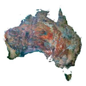
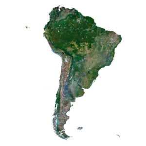
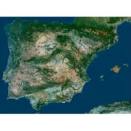
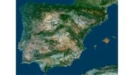
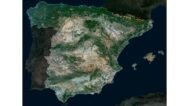
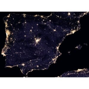
      Discover the stunning details of Spain with our Spain Satellite Map. This high-resolution map captures every nook and cranny of the Spanish landscape with exceptional clarity. Ideal for educational purposes, research, and personal exploration, this map offers a comprehensive view of Spain from space.

      Why You Should Buy

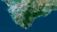
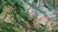
      • Exceptional Detail: The high resolution allows you to see intricate details such as city layouts, natural landscapes, and geographic features.
      • Versatile Application: Whether for academic research, classroom use, or personal interest, this map serves a variety of purposes.
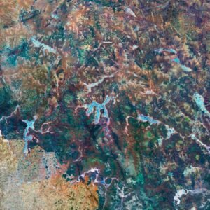
      • High-Quality Visuals: The large file size ensures that every part of the map remains sharp and detailed even when zoomed in.

      Lifestyle Integration

      • Educational Tool: Enhance your geographical knowledge and teaching resources with a detailed view of Spain.
      • Decorative Piece: Use this high-quality map as a decorative feature in your home or office, adding a touch of sophistication and curiosity.
      • Research Aid: Ideal for researchers and students needing detailed and accurate visual data of Spain’s landscape.

      By integrating cutting-edge satellite technology and comprehensive mapping techniques, our Spain Satellite Map stands out as a top choice for high-resolution satellite imagery.

      FAQ

      Can I use this map in GIS programs?

      This map is not geo-referenced, but feel free to contact us to obtain a file with geo data if needed.

      Can I get this map in a different projection?

      Yes, we offer custom projections upon request. Contact us for details.

      Can I get the map in a different format?

      Yes, if you need the map in a different file format, please contact us. We offer various formats to meet your needs.

      Is it possible to make a 3D model based on this satellite map?

      Yes, of course. Please specify the desired 3D model format, dimensions and how you will use it. This will help me to prepare an optimal model for you.

      Is it possible to get a higher resolution version of the map?

      Absolutely! If you require a higher resolution version, just let us know, and we can provide a version that fits your requirements.

      Can you provide the map with different projections or without boundaries?

      Yes, we can customize the map with different projections or remove boundaries as needed. Please reach out to us with your specifications, and we’ll accommodate your request.

      I need a custom size or additional features. What should I do?

      For custom sizes or additional features, please contact us directly. We are happy to work with you to create a tailored map that fits your specific needs.

      Can I print this map in large format?

      Absolutely! The map is available in high resolution, making it suitable for large format printing without losing detail. Be sure to check with your printing company if they require RGB-to-CMYK color conversion for best results.

      What other uses does this map have?

      In addition to educational and decorative uses, the map can be utilized for trip planning, natural resource research, and as a creative gift.

      If you have any other questions or special requests, feel free to get in touch with us. We’re here to help!

      Spain Satellite Map
      Spain Night Satellite Map
      Spain 3D Model Terrain Map
      Spain STL model

      Related products

      Australia satellite map
      Australia satellite imagery

      Australia Satellite Map

      $10.00
      Add to cart
      Israil 3D map
      Israil relief map

      Israel 3D Map

      $32.00
      Add to cart
      New Zealand map
      Topographic map New Zealand

      New Zealand 3D Map

      $32.00
      Add to cart
      Outline map of USA
      Map US outline

      Outline Map of USA

      $1.00
      Add to cart
      Outline Map of USA with States
      America map outline with states

      Outline Map of USA with States

      $0.00
      Add to cart
      Pakistan map
      Pakistan 3D map

      Pakistan 3D Map

      $32.00
      Add to cart
      -50%
      Satellite picture of Korea at night
      Satellite picture of Korea at night with border

      Satellite Picture of Korea at Night

      $10.00 Original price was: $10.00.$5.00Current price is: $5.00.
      Add to cart
      South America satellite map
      High-resolution satellite map of South America showing cities, forests, and rivers.

      South America Satellite Map

      $10.00
      Add to cart
      -50%
      United States night satellite image
      Night satellite view of USA

      United States Night Satellite Map

      $10.00 Original price was: $10.00.$5.00Current price is: $5.00.
      Add to cart
      Vietnam 3D map
      Vietnam terrain

      Vietnam 3D Map

      $32.00
      Add to cart
        INFO
        • About
        • Explore Our Terrain Services
        • Support
        • Shipping and delivery policy
        • Refund and Returns Policy
        • Privacy Policy
        • in**@***********ps.com
        • Blog
        How to buy
        • TERRAIN 3D MODELS FREE
        • Purchase with Crypto/PayPal/VISA
        • Buy on Cults3D.com
        • Buy on CGtrader.com
        • Buy on RenderHub.com
        • Buy on 3DExport.com
        • Discounts
        Buy 3D models
        • Planets
        • World
        • Continents
        • Peninsulas
        • Islands
        • Countries
        • States of America
        • Canadian Provinces
        • Canyons
        • Cities
        • Fantasy
        • Minecraft
        Buy 3D models for CNC
        • Planets
        • Continents
        • Islands
        • Countries
        • States of America

        DEM DSM DTM FBX OBJ STL

        SHUSTRIK-MAPS 2025
        • 3D MODELS
          • Solar System
          • World
          • Continents
          • Peninsulas
          • Islands
          • Countries
          • States of America
          • Canadian Provinces
          • Canyons
          • Buildings
          • Fantasy
          • ART
        • 3D PRINT/CNC MODELS
          • Planets
          • Satellites
          • Continents
          • Countries
          • Islands
          • States of America
          • Fantasy
          • Other
        • MAPS
        • A-Z
        • FREE
        • About
        • FAQ
        • How to buy?
        • Site Map HTML
        • Explore Our Terrain Services
        Shopping cart
        Close
        Start typing to see products you are looking for.
        Your amount to pay has been updated
        The previous conversion quote has expired. Here is your new quote:
        Total
        $
        You Pay
        Back to checkout
        Place Order