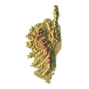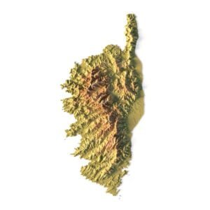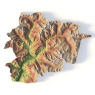
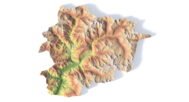
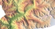
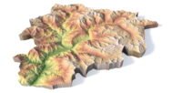
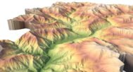
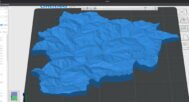
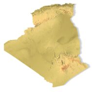

Andorra Topographic Map STL – 3D Terrain Model for 3D Printing & CNC Milling
$15.00
![]()
- File size: 119 MB
- Model size: 220 mm х 179 mm х 13 mm
- Projection: Mercator
- Scaling factor: X — 1; Y — 1; Z — 1
- Polygons: 2 496 940
- Vertices: 1 248 472
- Geometry: Polygonal Tris only
- Base: Closed
Andorra Topographic Map STL – High-Precision 3D Terrain Model
Andorra Topographic Map STL is a high-resolution 3D terrain model based on accurate digital elevation data (DEM), specifically prepared for 3D printing, CNC milling, and laser engraving. This STL file precisely represents the mountainous topography of Andorra, including elevation changes and terrain structure, making it ideal for professional, educational, and creative projects.
The model is delivered in STL format and features a clean, optimized polygonal mesh composed exclusively of triangular faces. This ensures reliable performance during FDM and SLA 3D printing, as well as smooth and accurate results when used for CNC machining in wood, plastic, acrylic, or metal. The closed base makes the model easy to manufacture and suitable for wall mounting or standalone display.
Applications:
🖨️ 3D Printing – compatible with FDM and SLA printers for creating educational tools, souvenirs, wall reliefs, and topographic models.
⚙️ CNC Milling – cut in wood, plastic, acrylic, or metal to produce decorative wall panels, interior elements, and custom gifts.
📚 Education & Science – create teaching aids for schools and universities in geography, geology, and history.
🏠 Interior & Decor – produce unique wall maps, 3D panels, or office design elements.
🎁 Souvenirs & Gifts – design collectible items or custom presents in the shape of Andorra’s map.
🎨 Design & Hobbies – use for landscape projects, creative experiments, or artistic models.


Why Choose Our Andorra Topographic Map STL Model?
✅ High-Precision Topography: The model delivers precise terrain representation and elevation data for a wide range of applications, from education to tourism and design.
✅ Multi-Purpose: Ideal for 3D printing, CNC machining, and laser engraving, this model offers versatility for professionals, hobbyists, and educators.
✅ Customizable: Modify the STL model to suit your project’s specific needs, whether for physical terrain models, geographic studies, or artistic designs.
Example Uses
Creating interactive physical maps
Elevation-based data modeling
Presentations and exhibitions
CNC-carved wooden landscape displays
Architectural prototyping and land-use planning
FAQ
The description includes scaling factors for each axis. For example, if you see X – 0.001, Y – 0.001, Z – 0.003, this means the height is three times greater than the width and length. We scale height this way to emphasize the relief.
If you need uniform proportions, let us know—we’ll prepare a custom model upon request.
Send us your required specifications, and we’ll adapt the model accordingly.
Yes, we check every model for integrity and errors.
Yes. For better surface quality, we recommend printing it vertically.
Larger models require more polygons to preserve relief detail. Provide your desired dimensions, and we’ll prepare:
A single optimized model or
A segmented version with high resolution.
Yes, but polygon reduction may be necessary. Submit a request with your project’s dimensions for a tailored solution.