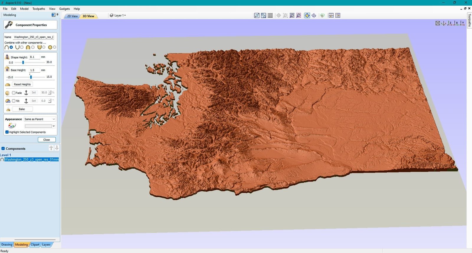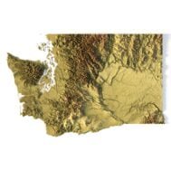
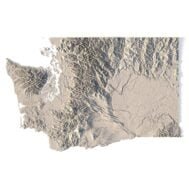
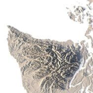
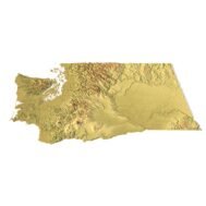
State of Washington STL model
$21.00
High-polygon 3D model state of Washington in STL format
![]()
- File size: 581 MB
- Model size: 347.8 mm x 226.2 mm x 5.375 mm
- Resolution: 0,1 mm
- Projection: Mercator
- Scaling factor: X — 1; Y — 1; Z — 3
- Polygons: 12 204 360
- Vertices: 6 119 509
- Geometry: Polygonal Tris only
- Base: Open
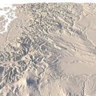
Washington is a state in the Pacific Northwest region of the Western United States. The state is bordered on the west by the Pacific Ocean, Oregon to the south, Idaho to the east, and the Canadian province of British Columbia to the north.
The high mountains of the Cascade Range run north-south, bisecting the state. In addition to Western Washington and Eastern Washington, residents call the two parts of the state the “Westside” and the “Eastside”, “Wet side” and “Dry side”, or “Timberland” and “Wheatland”. These terms reflect the geography, climate, and industry of the land on both sides of the Cascades.
What can I use a 3D model in STL format for?
STL model state of Washington can be used for various purposes:
- Making physical models from plastic or photopolymer using 3D printers
- Making models of wood or metal using CNC machines
- Making a high-resolution relief using 3D laser markers
- Making of “master forms” for duplication of products using foam polystyrene or concrete
- Creating computer graphics
- Creation of low-polygonal models for computer games


What is the resolution of the 3D model state of Washington?
With the development of technology, it is becoming possible to produce more and more precise relief models.
For example, there are 3D printers that can print models with a layer height of 0.16 mm, 0.1 mm, 0.05 mm, or even less. These devices require high-quality models. But a higher-quality 3D model contains more polygons and has a larger file size. One of the challenges is to find a compromise between the file size of the STL model, which would be convenient to work with, and the desired quality of the finished product.
The 3D model state of Washington has a fairly large size and many polygons.

How do I change the parameters of the STL model state of Washington?
You can easily resize the model in any program that allows you to import STL files.
In addition to changing the scale in width, length, and height, you can add a higher base. You can also use anti-aliasing tools, add bulk text, reduce the number of polygons, etc.