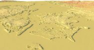


Denmark Topographic Map STL model
Original price was: $21.00.$17.00Current price is: $17.00.
![]()
- Files size: 179 MB / 189 MB
- Model size: 220 mm х 177 mm х 0.94 mm / 150 mm x1500 mm x 3.14 mm
- Projection: Mercator
- Polygons: 3 763 630 / 3 980 686
- Vertices: 1 882 659 / 1 990 345
- Geometry: Polygonal Tris only
- Base: Closed
Denmark Topographic Map STL Model for 3D Printing & CNC Milling
Bring the beauty of Danish geography into your creative or educational projects with this highly detailed Denmark Topographic Map STL model. Designed for FDM, SLA 3D printing, and CNC milling, this topography-based 3D model captures the natural terrain map of Denmark with stunning precision.
Perfect for Makers, Educators, and Creators
Whether you’re an artist, a student, or a professional modeler, this 3D model of Denmark’s topography is an exceptional resource for:
Educational geography projects
Landscape modeling
Cartographic demonstrations
Geospatial analysis
Decorative or functional art pieces
Two Versions Included: With and Without Sea Floor Relief
This digital download contains two STL files:
Denmark topographic model with sea floor relief
Denmark terrain map without sea relief
Choose the one that best suits your visualization or modeling software and digital elevation model needs.
High-Quality STL File for Versatile Applications
Crafted from authentic geographic data, this model is compatible with all major 3D printing and CNC carving platforms. Use materials like PLA, resin, metal, or wood to bring your vision to life.
Key Features
✔️ Accurate representation of Denmark’s topography
✔️ STL files optimized for smooth slicing and printing
✔️ Ready for FDM, SLA, and CNC workflows
✔️ Works with major modeling software like Blender, Fusion360, and Cura
✔️ Ideal for education, presentations, and decor