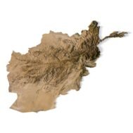
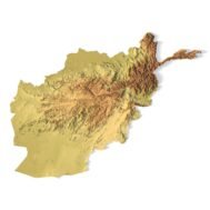
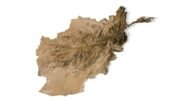
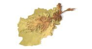
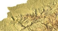
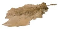
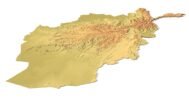
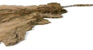
Afghanistan Terrain 3D model
$28.00
![]()
![]()
3D models
- Format: C4D
- File size (unzipped): 873 MB
- Polygons: 15 254 980
- Vertices: 7 639 536
- Geometry: Polygonal Tris only
- Model size: 1601.25 mm x 1221.15 mm x 14.869 mm
- Projection: Mercator
- Base: Open
- UV layer: Yes (frontal)
Added OBJ files with different Levels Of Detail (LOD)
- OBJ: LOD100/LOD50/LOD25
- Files size: 1.17 GB/887 MB/438 MB
- Polygons: 15 254 980/7 627 490/3 813 744
Textures
- Format: TIF
- File size: 162 MB
- Resolution: 8000*8000*48b
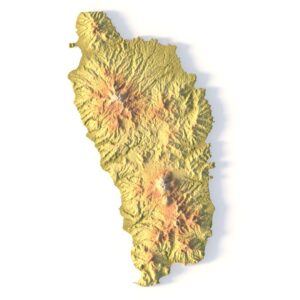
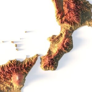
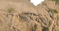
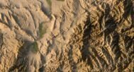
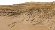
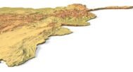
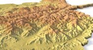
Afghanistan Terrain 3D model is a highly detailed, realistic representation of the topography of Afghanistan. This model can be used for a variety of purposes, including graphic design, 3D printing, and CNC milling.
The model is created using high-resolution elevation data and satellite imagery, ensuring a high level of accuracy and detail. It includes features such as mountains, valleys, rivers, and lakes. The terrain is rendered in 3D, giving a sense of depth and realism.
The model can be used in graphic design to create realistic backgrounds for maps, illustrations, and animations. It can also be used for 3D printing, allowing users to physically hold and examine the terrain. The model can also be used for CNC milling, allowing for the creation of physical models of the terrain for educational or display purposes.
One of the key features of this model is the level of detail it provides. The mountains and valleys are accurately represented, and the texture and shading give the impression of a real-world landscape. The model can be viewed from any angle, allowing for a detailed examination of the terrain.

In addition to the 3D terrain map of Afghanistan, I can attach a map of heights, shape-files and various satellite textures.
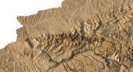
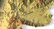
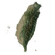
Afghanistan DEM

The elevation map is used to get information about low and high parts of the Afghanistan relief.
Shapefile of Afghanistan

The shapefile is used to cut along the contour.
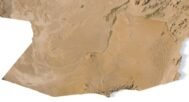
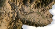
Satellite image of Afghanistan

The satellite texture is high resolution in TIF format.
Have a Question?
Do you need Shapefile?
Do you need more resolution satellite images?
Do you need a 3D models in BLEND, OBJ or FBX format?
Related products