 Solar System
 World
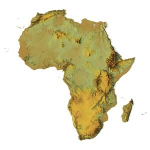
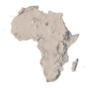
World Continents
 Peninsulas
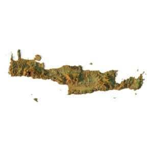
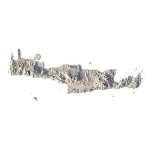
 Islands
 Countries
 States of America
 Canadian Provinces
 Parks & Canyons
 Fantasy
 Other
Other Planets
 Satellites
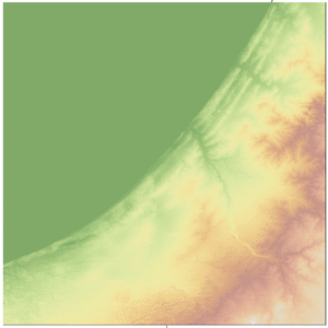
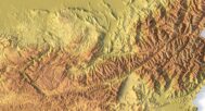
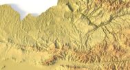
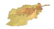
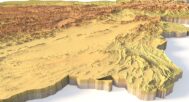
Explore Afghanistan’s dramatic and diverse landscape with our high-resolution Afghanistan Topographic Map STL Model. This detailed 3D model captures Afghanistan’s towering mountain ranges, rugged valleys, and expansive plateaus, making it ideal for relief maps, educational projects, and design work. Whether you’re studying Afghanistan’s terrain or using it for a creative project, this model offers accurate elevation data and precise landform analysis.


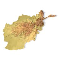
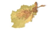

Afghanistan Topographic Map – 3D Model for 3D Printing & CNC Carving
$15.00
Detailed Terrain STL Model of Afghanistan’s Landscapes
![]()
- File size: 277 MB
- Model size: 200 mm * 152 mm * 3.4 mm
- Scale: X=0.001, Y=0.001, Z=0.003
- Projection: Mercator
- Polygons: 5 823 500
- Vertexes: 2 911 753
- Geometry: polygonal tris only
- Base: closed
Description
Applications of the Afghanistan Topographic STL Model
-
3D Printing: Create physical models of Afghanistan’s terrain using FDM or SLA 3D printers, showcasing the country’s elevation data and unique terrain representation.
-
CNC Machining: Perfect for crafting detailed relief maps from wood or metal, this model offers precise details for professional design and geographic analysis.
-
Laser Engraving: Use this model for high-precision laser engraving on metals, capturing the intricate topography of Afghanistan in great detail.
Detailed Terrain Representation for Educational and Professional Use
This Afghanistan topographic map offers a comprehensive digital elevation model, providing accurate elevation data for researchers, educators, and designers. From the Hindu Kush mountains to the Kabul Basin, this model accurately reflects Afghanistan’s geographical features, making it a key resource for landform analysis and terrain visualization.
Bring Afghanistan’s landscapes to life with our Afghanistan Topographic Map STL Model. Download now to create detailed and customizable 3D models of Afghanistan’s diverse terrain.


Why Choose This Afghanistan STL Terrain Map?
✔ Precision landform representation
✔ Printable and carveable in various sizes and materials
✔ Excellent detail of Afghan topography
✔ Ready-to-use for creative, academic, and design projects
✔ Designed with terrain modeling and realism in mind
Sample Use Cases
-
Print a classroom-ready model of Afghanistan’s mountainous topography
-
CNC-carve the country’s rugged terrain into wood or metal
-
Build elevation-aware 3D architectural site layouts
-
Create Afghanistan-themed 3D art or display pieces
-
Produce unique souvenirs for geography enthusiasts
FAQ
Are the model’s proportions realistic?
The description includes scaling factors for each axis. For example, if you see X – 0.001, Y – 0.001, Z – 0.003, this means the height is three times greater than the width and length. We scale height this way to emphasize the relief.
If you need uniform proportions, let us know—we’ll prepare a custom model upon request.
How can I adjust the model’s height?
Send us your required specifications, and we’ll adapt the model accordingly.
Is the model waterproof?
Yes, we check every model for integrity and errors.
Can it be printed on FDM printers?
Yes. For better surface quality, we recommend printing it vertically.
How to CNC-cut a very large map?
Larger models require more polygons to preserve relief detail. Provide your desired dimensions, and we’ll prepare:
-
A single optimized model or
-
A segmented version with high resolution.
Can I get the model in STEP format?
Yes, but polygon reduction may be necessary. Submit a request with your project’s dimensions for a tailored solution.
Related products


Original price was: $20.00.$14.00Current price is: $14.00.
