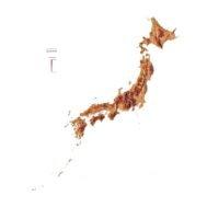
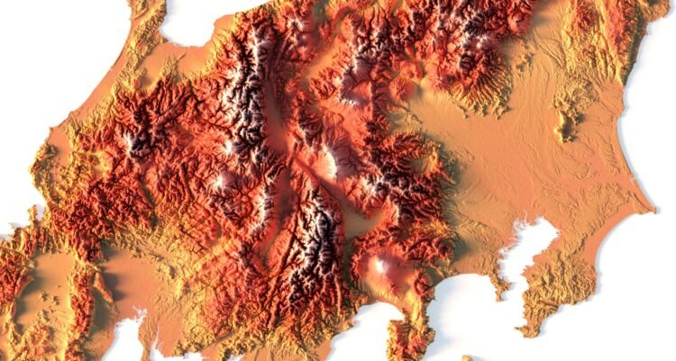
Relief map of Japan
High-resolution relief map of Japan in PSD format
![]()
- Linear size: 84.6 x 84.6 cm
- Pixel resolution: 100 MPx (10 000 px x 10 000 px)
- File size: ~700 MB
- Color Depth: 16 Bit/channel
- Color model: CMYK
- ICC-profile: U.S. Web Coated (SWOP) v2
- Print resolution: 300 DPI
- Scaling factor: X – 0.0000001; Y – 0.0000001; Z – 0.0000010
- Projection: Mercator
Japan is a chain of islands located in Eastern Asia in the North Pacific Ocean. There are an estimated 6,800 islands in the entire archipelago of Japan. But its 4 main islands are Honshu, Kyushu, Hokkaido and Shikoku. First, Honshu is home to major cities like Tokyo (Japan’s capital and largest city), Yokohama, Osaka, Kyoto, and Kobe. Secondly, Kyushu is its southwesternmost main island situated near the Korean Peninsula (South Korea). Next, Hokkaido is the northernmost main island known for its colder climate. Finally, Shikoku is the smallest of the four main islands and is separated by the Inner Sea from the rest of Japan. But some consider Okinawa as the fifth main island, which has a more tropical climate.

Color design for the relief map of Japan
You can change the color scheme of the relief map yourself in Photoshop or any other graphics editor.
You can also add your own text or additional graphics.


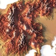
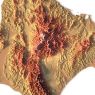
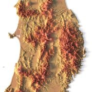
Relief map of Japan at 100% zoom
Related products