 Solar System
 World
World Continents
 Peninsulas
 Islands
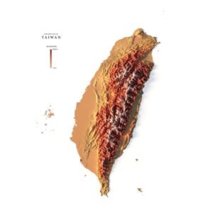
 Countries
 States of America
 Canadian Provinces
 Parks & Canyons
 Fantasy
 Other
Other Planets
 Satellites
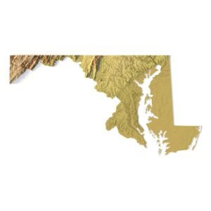
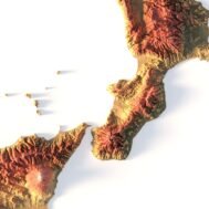
Italy is located in southern Europe along the Mediterranean Sea. It borders 4 countries to the north including France, Switzerland, Austria, and Slovenia. Also, the microstates of San Marino and Vatican City are enclaves completely surrounded by Italy. Italy looks like the shape of a boot because of how its peninsula extends southward into the Mediterranean Sea. The country’s landmass also includes Sicily and the island of Sardinia in the west, across the Tyrrhenian Sea. Italy is known for its art, architecture, culture, fashion, and food. Rome is the capital and largest city in Italy. But Milan, Naples, and Turin are other large cities.


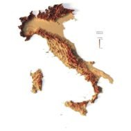
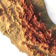
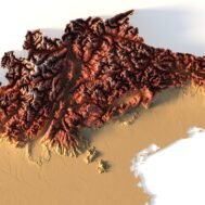
Relief map of Italy
$15.00
High-resolution relief map of Italy in PSD format
![]()
- Linear size: 84.6 x 84.6 cm
- Pixel resolution: 100 MPx (10 000 px x 10 000 px)
- File size: ~700 MB
- Color Depth: 16 Bit/channel
- Color model: CMYK
- ICC-profile: U.S. Web Coated (SWOP) v2
- Print resolution: 300 DPI
- Scaling factor: X – 0.0000001; Y – 0.0000001; Z – 0.0000015
- Projection: Mercator


