Solar System
 World
World Continents
 Peninsulas
 Islands
 Countries
 States of America
 Canadian Provinces
 Parks & Canyons
 Fantasy
 Other
Other Planets
 Satellites


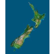
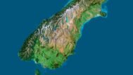
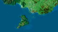
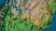
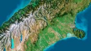
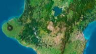
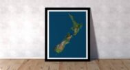
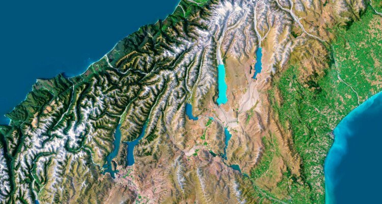
Discover the stunning landscapes of New Zealand with our 3D map, offering an immersive experience for terrain mapping, geospatial representation, and educational or design projects. This digital elevation model brings New Zealand’s topography to life, making it ideal for various applications including interactive cartography and landscape analysis.
Key Features of Our 3D Map of New Zealand
- Topographical Visualization: The model provides detailed topographical visualization of New Zealand’s diverse terrain, including mountains, plains, and coastal areas.
- Versatile Applications: Perfect for 3D modeling, educational projects, or design work. Use it in geographic information system (GIS) applications or virtual reality landscape presentations.
Accurate Digital Elevation Model for Geospatial Analysis
This 3D map of New Zealand offers precise elevation data, making it an essential tool for landscape analysis and geospatial representation. Whether you’re studying New Zealand’s terrain or using it for design purposes, this model guarantees accurate topographical detail and clarity.
Ideal for Interactive Cartography and Virtual Reality Projects
The model is designed for interactive cartography and can be integrated into virtual reality landscape projects, providing a dynamic way to explore and understand New Zealand’s geography.
Why Choose Our 3D Map of New Zealand?
- Highly Detailed: The map delivers precise digital elevation and detailed terrain features for accurate analysis.
- Multi-Purpose: Suitable for design, educational, and GIS applications, offering flexibility across various industries.
- Customizable: Easily integrated into presentations, virtual environments, or physical models for customized projects.
Explore the richness of New Zealand’s landscape with our 3D map, offering both beauty and functionality for any project. Download now and bring New Zealand’s topography to life!