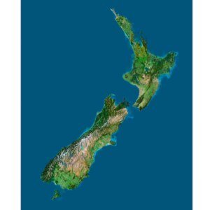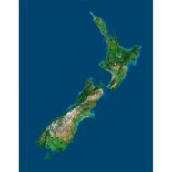
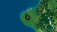
New Zealand Satellite Image
$15.00
New Zealand Satellite Image: High-Resolution Aerial View of Topography and Natural Features
- Format: TIF
- Resolution: 12000*15404 px
- Depth: 24 bit
- Size: 75 MB
- Color scheme: RGB
- Projection: Mercator
Explore the breathtaking beauty of New Zealand with our New Zealand Satellite Image. Captured using advanced earth observation and remote sensing technologies, this high-resolution map offers an unparalleled aerial view of the country’s diverse landscapes. Whether you’re an educator, designer, or enthusiast, this map serves as a valuable tool for understanding New Zealand’s topographic features and natural environment.
Key Features of the New Zealand Satellite Map
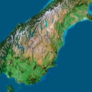
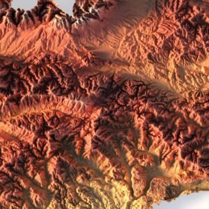
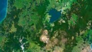
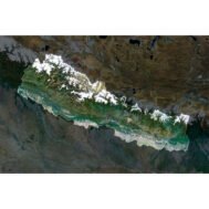
- High-Resolution Detail: The satellite imagery provides clear views of New Zealand’s land cover, from the peaks of the Southern Alps to the coastal plains and natural landmarks.
- Versatile Applications: Perfect for educational tools, decorative displays, or custom design projects, this satellite image adapts to many uses with precision and clarity.
Educational Uses of New Zealand Satellite Imagery
Ideal for teaching geography, geology, and environmental science, this satellite map aids in understanding New Zealand’s terrain, natural resources, and ecosystem. Use it to demonstrate the impact of climate change or explore vegetation mapping and coastal management in New Zealand.
Decorative and Custom Project Ideas
Transform your space with this stunning map, perfect for framing as a decorative piece or integrating into design projects. Its sharp imagery ensures a high-quality presentation whether displayed in large or small formats, making it a standout piece for homes, offices, or educational settings.
Why Choose Our New Zealand Satellite Image?
- High Clarity: The exceptional resolution maintains detail even at large scales, making it perfect for aerial maps of NZ.
- Multi-Purpose: Suitable for geospatial data analysis, climate monitoring, or educational projects.
- Customizable: Ideal for both digital and print formats, the map can be used for everything from academic presentations to artistic projects.
With its precision and versatility, this New Zealand satellite image is a must-have resource for anyone passionate about the geography of this beautiful region. Bring New Zealand’s landscapes to life in your home or project today!
FAQ
This map is not geo-referenced, but feel free to contact us to obtain a file with geo data if needed.
Yes, we offer custom projections upon request. Contact us for details.
Yes, if you need the map in a different file format, please contact us. We offer various formats to meet your needs.
Yes, of course. Please specify the desired 3D model format, dimensions and how you will use it. This will help me to prepare an optimal model for you.
Absolutely! If you require a higher resolution version, just let us know, and we can provide a version that fits your requirements.
Yes, we can customize the map with different projections or remove boundaries as needed. Please reach out to us with your specifications, and we’ll accommodate your request.
For custom sizes or additional features, please contact us directly. We are happy to work with you to create a tailored map that fits your specific needs.
Absolutely! The map is available in high resolution, making it suitable for large format printing without losing detail. Be sure to check with your printing company if they require RGB-to-CMYK color conversion for best results.
In addition to educational and decorative uses, the map can be utilized for trip planning, natural resource research, and as a creative gift.
Related products