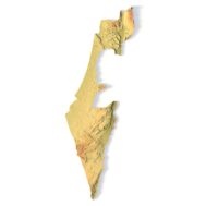
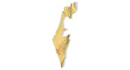
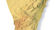
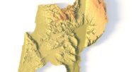
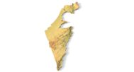
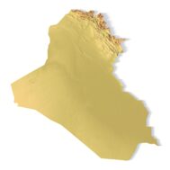
Israel Topographic Map – 3D Printable STL Terrain Model for CNC Carving
$15.00
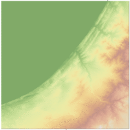
![]()
- File size: 265 MB
- Model size: 181 mm x 502 mm x 11 mm
- Projection: Mercator
- Scaling factor: X — 0,001; Y — 0,001; Z — 0,003
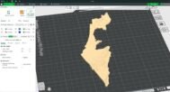
- Polygons: 5 560 668
- Vertices: 2 780 235
- Geometry: Polygonal Tris only
- Base: Closed
High-resolution Israel topographic map 3D model in STL format. Perfect for FDM/SLA 3D printing and CNC Israel map carving.
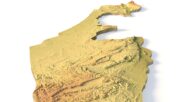
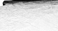
The Israel Topographic Map is a high-resolution STL terrain model based on precise digital elevation model (DEM) data. This printable Israel map STL accurately represents the country’s landscapes, including the Judean Mountains, Negev Desert, coastal plains, and the Dead Sea basin.
Whether you need a 3D printable Israel relief map for education, design, or CNC production, this model is optimized for PLA, resin, wood, metal, and other materials. It is perfect for geography enthusiasts, architects, and designers.


Features:
✔ Realistic Israel Relief Map STL – Created from authentic geospatial DEM data
✔ Printable Israel Map STL – Works with FDM and SLA 3D printers
✔ CNC Israel Map Carving Ready – Perfect for wood, aluminum, or acrylic engraving
✔ Polygonal Mesh – Triangles only, clean and ready for slicing
✔ Closed Base – Ensures strong, high-quality prints
Example Uses:
3D print a raised-relief map of Israel for educational projects
CNC carve a detailed terrain model for exhibitions or souvenirs
Produce custom wall maps or geography-themed gifts
Integrate into architectural and landscape presentations
FAQ
The description includes scaling factors for each axis. For example, if you see X – 0.001, Y – 0.001, Z – 0.003, this means the height is three times greater than the width and length. We scale height this way to emphasize the relief.
If you need uniform proportions, let us know—we’ll prepare a custom model upon request.
Send us your required specifications, and we’ll adapt the model accordingly.
Yes, we check every model for integrity and errors.
Yes. For better surface quality, we recommend printing it vertically.
Larger models require more polygons to preserve relief detail. Provide your desired dimensions, and we’ll prepare:
A single optimized model or
A segmented version with high resolution.
Yes, but polygon reduction may be necessary. Submit a request with your project’s dimensions for a tailored solution.