Solar System
 World
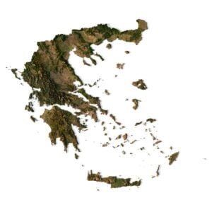
World Continents
 Peninsulas
 Islands
 Countries
 States of America
 Canadian Provinces
 Parks & Canyons
 Fantasy
 Other
Other Planets
 Satellites
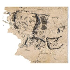
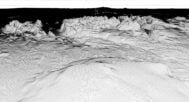
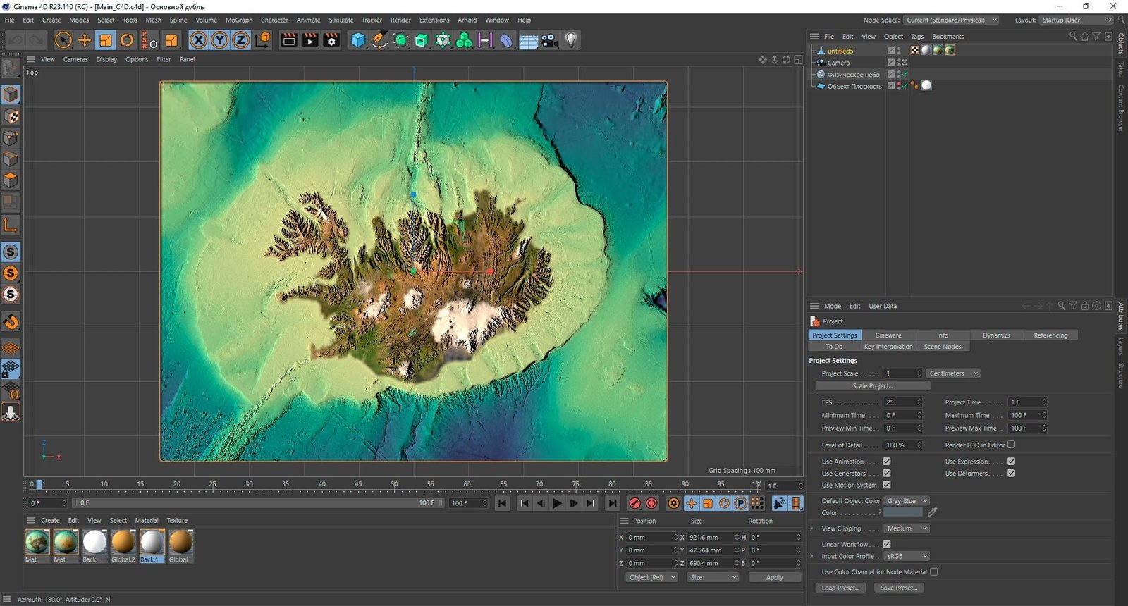
The Iceland relief without water 3D model is a highly detailed, digital representation of Iceland’s topography. It is designed for use in CNC machining, 3D printing, and other design applications. This model features the island’s rugged terrain and dramatic landscapes, including glaciers, mountains, and volcanic features, but does not include any water bodies like lakes and rivers. The model is available in a variety of file formats, making it compatible with a wide range of software and machines. With its high level of detail and accuracy, this model is ideal for use in architectural visualization, cartography, geology research, and other applications that require accurate representation of the Iceland’s terrain. Additionally, it could be also used as a base for 3D printing, CNC cutting, and other physical creations. It is a great tool for anyone looking to create high-quality, detailed models of Iceland’s unique and beautiful landscapes.
-33%


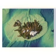
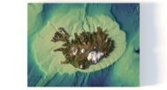
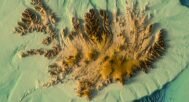

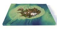
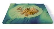
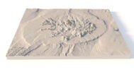
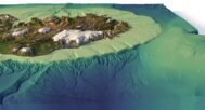
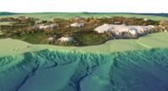
Iceland Terrain Without Water 3D Model
Original price was: $30.00.$20.00Current price is: $20.00.
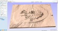
Buy 3D model of Iceland in C4D format.
![]()
3D model
- Format: C4D
- File size: 1.16 GB
- Polygons: 20 891 648
- Vertices: 10 452 289
- Geometry: Polygonal Tris only
- Model size: 921.6 mm x 690.4 mm x 47.564 mm
- Projection: Mercator
- Base: Open
Textures
- Format: TIF
- File size: 82.6 MB
- Resolution: 5000*5000*48b
Other models can be made on request.
Modifications, more detailed models and better textures on request.
[idcore id=”21″]
Description
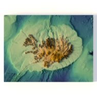
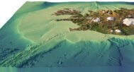
In addition to the 3D terrain map of Iceland, I can attach a map of heights and various satellite textures.
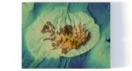
Iceland DEM

The elevation map is used to get information about low and high parts of Iceland relief.
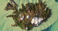
Iceland Texture

The texture is high resolution in TIF format.
Have a Question?
Do you need an extra high resolution 3D terrain models?
Do you need Shapefile of Iceland and regions?
Do you need more resolution satellite Iceland images?
Do you need a 3D models in BLEND, OBJ or FBX format?
Do you need Shapefile of Iceland and regions?
Do you need more resolution satellite Iceland images?
Do you need a 3D models in BLEND, OBJ or FBX format?