


3D Model of Europe (C4D, OBJ) with High-Res Relief & Textures
$28.00
![]()
![]()
3D models
- Format: C4D/OBJ
- File size: 228 MB/301 MB
- Polygons: 3 980 974
- Vertices: 1 994 812
- Geometry: Polygonal Tris only
- UV Map: yes, frontal
- Model size: 525.184 mm x 410.822 mm x 5.653 mm
- Projection: Lambert Conformal Conic
- Base: Closed
Textures
- Format: TIF
- File size: 202 MB
- Resolution: 8412*8191*24b
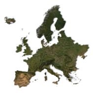
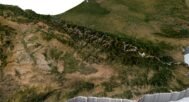
3D Model of Europe (C4D, OBJ) — a production-ready asset for designers, animators, developers, and educators who need a realistic, performance-balanced Europe 3D map. The model ships with a high-resolution satellite texture, an optional country-borders overlay, and a pseudo-color texture to emphasize landforms and geographic features. Thanks to an optimized polygonal mesh and frontal UV mapping, textures align precisely with the continental relief for crisp, artifact-free rendering.
Why this Europe 3D model
– Realism & clarity: Frontal UV unwrap ensures accurate texture placement and clean edges for borders and coastlines.
– Performance-friendly: Balanced polygon count delivers smooth interaction and fast renders in Cinema 4D, Unity, Unreal Engine, Blender, and more.
– Flexible texturing: Satellite, borders, and pseudo-color textures included to cover data-driven, cinematic, and infographic use cases.
Where it fits best
– Animation & video — flyovers across Europe, climate change visualizations, historical reconstructions, broadcast graphics.
– Games & simulators — realistic world maps and strategy/sim backdrops with engine-friendly assets.
– Education — teaching geography, climate, ecology, and history in films, lessons, and interactive apps.
– Web design & interactive 3D — lightweight embeds for multimedia sites and dashboards.
– AR/VR experiences — immersive virtual tours and spatial storytelling across Europe.
– Tourism & marketing — promo videos, destination explainers, and branded map visuals.
– Architecture & concept design — context maps for site analysis and territory presentations.
– Posters & infographics — high-quality stills for large-format printing.


This Europe 3D model combines visual fidelity with practical performance, making it a dependable base asset for motion design, game development, cartography, and data storytelling. Integrate it into your pipeline, switch textures as needed, and render sharp, informative visuals—fast.
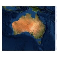
In addition to the 3D terrain of Europe, I can attach a map of heights and various satellite textures.
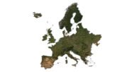
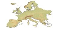
Europe DEM

The elevation map is used to get information about low and high parts of the Europe relief.
Europe Shapefile

The shapefile is used to cut the 3D map along the contour.
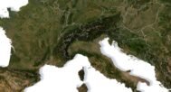
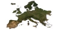
Satellite image of Europe

The satellite texture is high resolution in TIF format.
Have a Question?
Do you need Shapefile and regions?
Do you need more resolution satellite images?
Do you need a 3D map in BLEND, OBJ or FBX format?