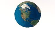
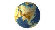
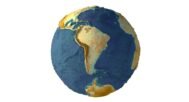
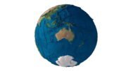
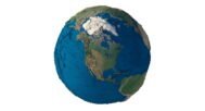
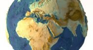
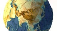


Earth 3D model Terrain Without Water
Original price was: $40.00.$32.00Current price is: $32.00.
Earth Without Water 3D Model – Explore Earth’s Dry Terrain
![]()
![]()
- Format: C4D/ OBJ LOD50/ OBJ LOD25
- File size (unzipped): 1.4 GB/ 2.08 GB/1.2 GB
- Polygons: 32 854 640 / 14 894 568 / 7 854 966
- Vertices: 15 728 642 / 7 445 654 / 3 865 988
- Geometry: Polygonal Quads only
- Model size: 1147.743 mm x 1176.364 mm x 1169.712 mm
- UV layer: Yes
Textures
- Format: TIF
- File size: 236 MB
- Resolution: 17280*8640*24b
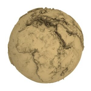
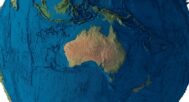
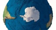
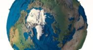
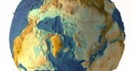
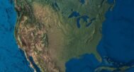
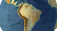
Discover the hidden landscapes beneath the oceans with our Earth Without Water 3D Model. This unique model reveals the earth’s shape without water, showcasing the detailed topographical features of the planet’s surface. Perfect for 3D visualization, graphic design, and scientific applications, this model brings Earth’s dry terrain to life, offering a visually stunning and scientifically accurate representation.
Key Benefits of the Earth Without Water 3D Model
- Educational Value: Perfect for teaching geography, geology, and environmental science, the model offers an in-depth view of geological formations and surface mapping that would otherwise be hidden under water.
- Versatility: Whether you’re working on climate simulations, creating 3D printed models, or designing arid terrain landscapes, this model adapts to multiple uses.
- High Precision: The detailed topography ensures enhanced realism, making it suitable for geological studies, CNC milling, and professional ecosystem representations.

Applications for the Earth Without Water Model
- Graphic Design & Visualization: Add a scientifically accurate and visually compelling element to educational content, environmental campaigns, and creative projects with a unique look at the dry planet.
- 3D Printing & CNC Milling: Create accurate 3D maps of the Earth without water, and bring the hidden geological formations to life as physical models.
- Education & Research: Utilize this model to study Earth’s topography, perfect for lessons and research in geology, surface mapping, and climate simulations.
Technical Specifications
- High-Resolution Mesh: The model is created with high-detail 3D visualization, perfect for both digital use and physical reproduction.
- Realistic Topography: The terrain is accurately represented without water, showing Earth’s natural landscape with geological precision.
Unlock the mysteries of the world’s submerged landscapes with the Earth Without Water 3D Model today. Whether you’re creating digital content or physical models, this resource is essential for professionals and enthusiasts alike.
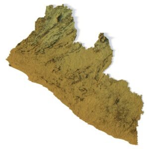
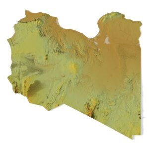
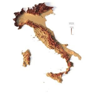
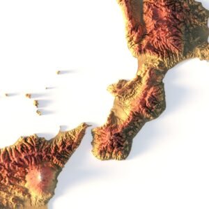
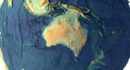
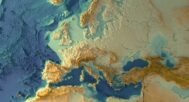
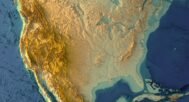
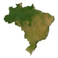
Earth terrain DEM

The elevation map is used to get information about low and high parts of the Earth relief.
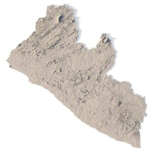
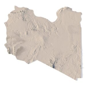
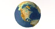
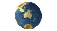
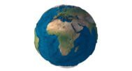
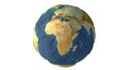
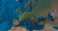
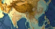
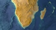
Satellite image of Earth

The satellite texture is high resolution in TIF format.
Have a Question?
Do you need Shapefile?
Do you need more resolution satellite images?
Do you need a 3D models in BLEND, OBJ or FBX format?
Related products