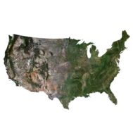
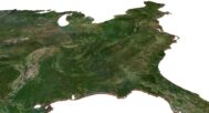
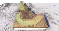
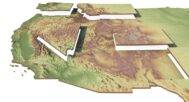


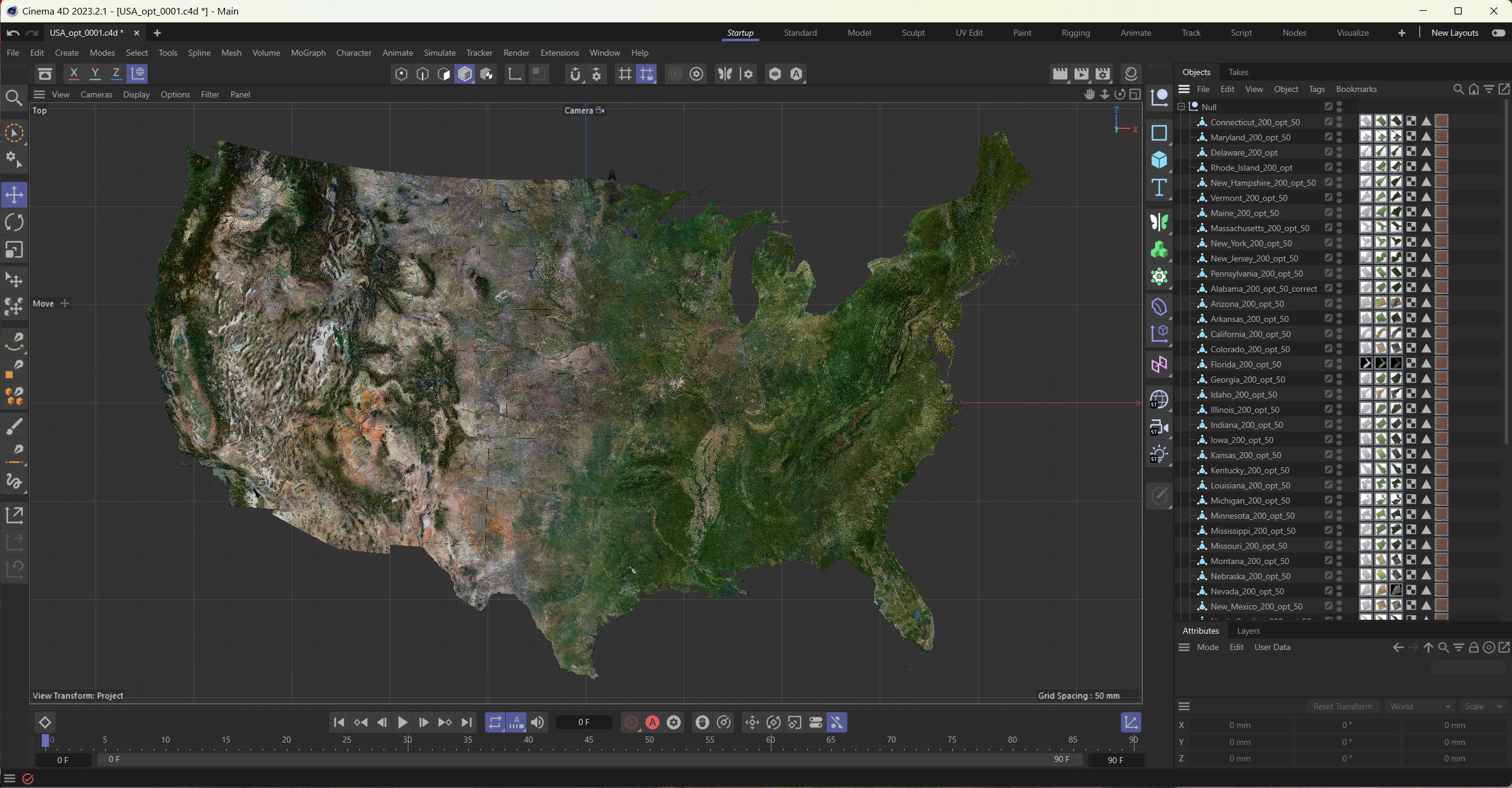
Contiguous 48 USA States 3D Model
Original price was: $300.00.$190.00Current price is: $190.00.
The Ultimate 3D Model for Visualization and Educational Applications
![]()
![]()
3D model (48 meshes):
- Format: C4D / OBJ
- File size (unzipped): 673 MB / 926 MB
- Polygons (total quantity): 11 586 716
- Vertices (total quantity): 5 800 148
- Geometry: Polygonal Tris only
- Scale factor: X = 1, Y = 1, Z = 3
- Projection: Lambert Conformal Conic
- Base: Close
Textures:
- Format: TIF
- Files size (unzipped): all 48 states – 2.12 GB
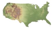
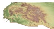
A Detailed and Accurate 3D Representation of the Contiguous 48 U.S. States
This Contiguous 48 USA States 3D Model is designed for high-quality visualization, educational projects, and creative applications. Whether you are an educator, designer, or developer, this model provides a realistic and interactive representation of the United States.
Key Features of the Model
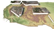
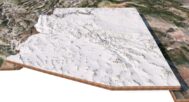
✔️ Low-Polygon Mesh for Optimal Performance
Each of the 48 states is carefully designed with a low-polygon structure, ensuring smooth rendering and easy integration into various applications.
✔️ High-Resolution Textures for Maximum Realism
The model includes multiple texture sets to enhance its usability and realism:
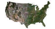
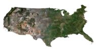
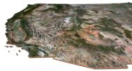
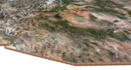
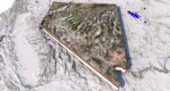
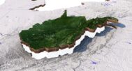
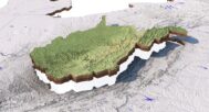
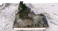
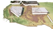
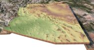
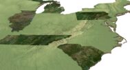
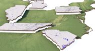
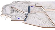
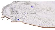
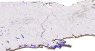
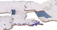
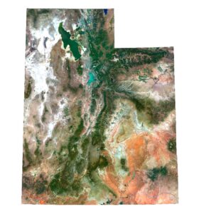
Satellite Texture – Provides real-world imagery for authentic geographic representation.
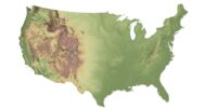
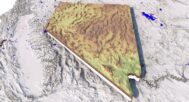
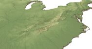
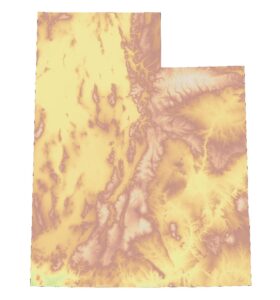
Pseudocolor Elevation Texture – Highlights terrain features where colors change based on elevation levels.
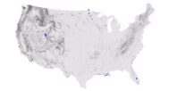
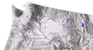
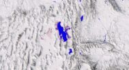
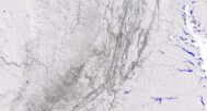
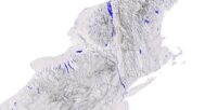
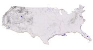
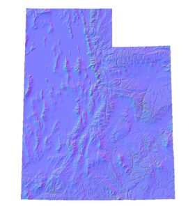
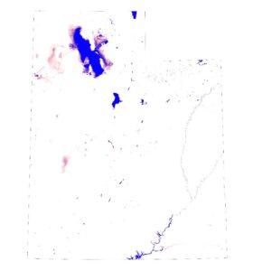
Water Body Map – Clearly marks lakes, rivers, and coastlines for precise mapping.
Normal Map (From High-Resolution Model) – Adds fine details by simulating high-resolution terrain on a low-poly mesh.
- UV Map (frontal projection)
✔️ Seamless Integration with 3D Applications
This 3D geography model is compatible with various rendering engines and creative software. Whether used for interactive maps, 3D visualization, or game environments, it ensures a smooth and accurate representation of the United States.
Why Choose This 3D Model?
✅ Optimized for High-Quality Renders – With normal maps from a high-resolution source, the model achieves exceptional detail in topographic features.
✅ Perfect for Educational and Professional Use – A must-have for teachers, researchers, and designers working on U.S. geography projects.
✅ Multiple Formats Available – Compatible with Blender, 3ds Max, Unity, Unreal Engine, and more.
✅ Customizable & Ready for Modifications – Can be used as is or edited to fit specific project needs.
Ideal Use Cases
Educational Tools – Perfect for schools and universities to teach geography interactively.
Game & VR Development – Create realistic U.S. landscapes for immersive experiences.
Architectural & Urban Planning – Utilize for topographic analysis and city planning.
Media & Film Production – High-quality renders suitable for documentaries and simulations.
Each of the 48 states contains:
Optimized low-polygon mesh
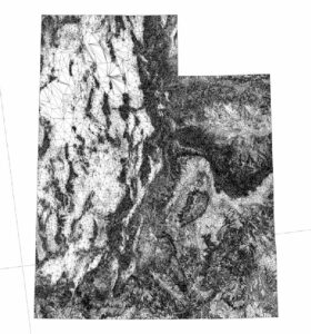
Normal Map
Satellite Map
Pseudo-color map
River and lake map
Have a Question?
Do you need Shapefile?
Do you need more resolution satellite images?
Do you need a 3D model in BLEND, OBJ or FBX format?
Related products