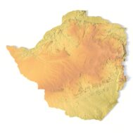
Zimbabwe Map 3D Model
$25.00
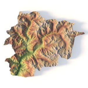
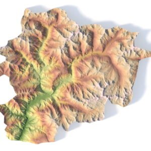
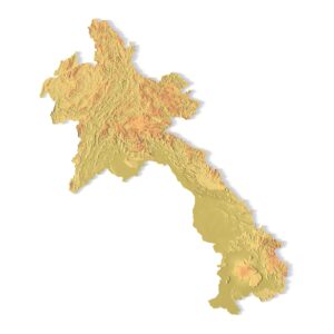
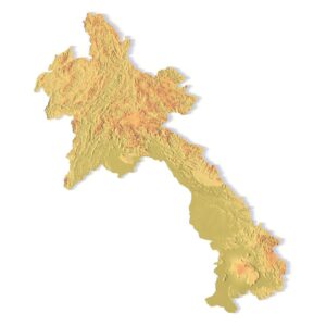
Zimbabwe Map – High-Quality Terrain for Visualization
![]()
![]()
3D model:
- Format: C4D / OBJ
- File size (unzipped): 22.2 MB / 27.7 MB
- Polygons (total quantity): 381 028
- Vertices (total quantity): 190 517
- Geometry: Polygonal Tris only
- Scale factor: X = 1, Y = 1, Z = 3
- Projection: Mercator
- Base: Close
Textures:
- Format: TIF
- Resolution: 100 MPx (10000*10000 px)
- Files size (unzipped): 433 MB
Unlock the Beauty of Zimbabwe in 3D
Bring the rich and diverse landscape of Zimbabwe into your digital project with this highly detailed 3D map model. Perfect for landscape visualization, geographical applications, educational tools, and game environments, this asset is both visually compelling and technically sound.
🌍 Key Features of the 3D Zimbabwe Map Model
🧩 Low-Polygon Mesh with High-Fidelity Detail
This model uses a low-poly base mesh, which makes it lightweight and efficient for real-time rendering. Combined with baked normal maps from a high-res source, it delivers a high level of detail while maintaining performance.
🗺️ Multiple Textures Included
To meet various project needs, the package includes:
Satellite Texture – for realistic Earth-based visuals
Pseudocolor Elevation Texture – colorized by elevation to highlight topography
Water Bodies Map – marks lakes and rivers for added realism
Normal Map – gives depth and shading derived from a high-res terrain
UV Map – clean and efficient layout for all textures
🧭 True-to-Life Geographic Accuracy
Built using real-world elevation data, this topographic model represents Zimbabwe’s natural terrain, plateaus, basins, and water features with precision.
🧠 Ideal For
📚 Educational & Scientific Applications
Enhance geography lessons or environmental studies with an interactive map that students can explore in 3D.
🕹️ Game Development
Use the digital mapping asset in open-world exploration games or strategy simulators.
🏗️ Architectural & Creative Projects
Inspire stunning cartographic designs and landscape visualizations with this flexible, easy-to-integrate terrain model.

UV-Map

Optimized low-polygon mesh

Normal Map

Satellite Map

Pseudo-color map

River and lake map

Have a Question?
Do you need Shapefile?
Do you need more resolution satellite images?
Do you need a 3D model in BLEND, OBJ or FBX format?