
Asia 3D Model Terrain
$35.00
Asia Terrain 3D Model – Detailed 3D Topography for Your Creative Projects
![]()
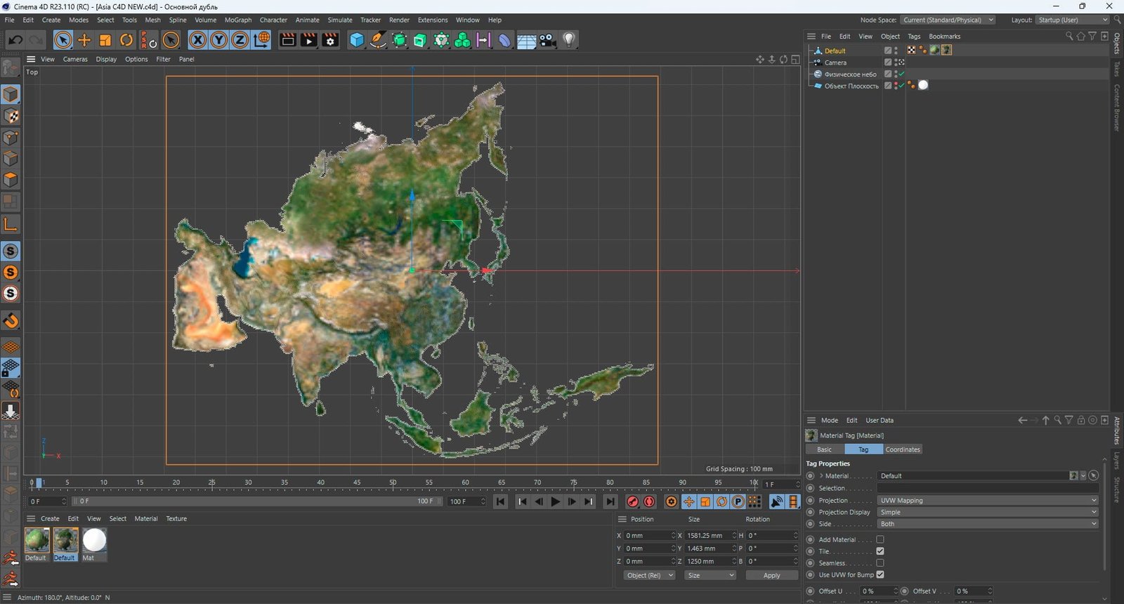
3D model
- Format: C4D (export to OBJ/FBX on request)
- File size (unzipped): 571 MB
- Polygons: 9 986 662
- Vertices: 4 997 832
- Geometry: Polygonal Tris only
- Model size: 1581.25 mm x 1250 mm x 1.463 mm
- Projection: Equidistan Conic
- Base: Open
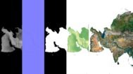
Textures
- Height Map TIF 8192*6476*16b – You can use this map in the displacement channel instead of the polygonal mesh.
- Normal Map TIF 8192*6476*48b – Use this map to reveal fine details of the relief.
- Satellite Map TIF 12650*10000*48b
- Water Mask TIF 12650*10000*48b – Use this map for masking in the Reflection channel to get glare from the water surface.
- Pseudo-color Map 12650*10000*48b – Use this map to get elevation information based on the color shade.
- Boundary Mask TIF 12650*10000*48b – Use this map as a mask for your background.
Looking for a high-quality, detailed 3D model of Asia’s topography? Our Asia Terrain 3D Model offers an unparalleled representation of the continent’s natural features, making it ideal for creative projects, architectural renderings, and educational purposes.
Unmatched Precision and Detail
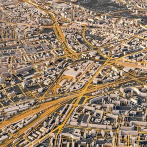
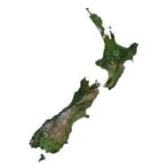
Our Asia Terrain 3D Model captures the vast and diverse landforms across Asia, from majestic mountain ranges to expansive river valleys and rugged deserts. Every elevation and geographic feature has been meticulously crafted using cutting-edge data collection technologies to ensure an accurate and immersive experience.
Realistic Textures for Authenticity
This model includes high-resolution textures that bring Asia’s landscapes to life, showcasing the realistic beauty of everything from plateaus and plains to mountainous terrains and climate zones. These textures help your 3D renderings look more lifelike, perfect for games, films, or even urban planning projects.
Versatile Use for Designers and Educators
Whether you’re a 3D designer, artist, or educator, the Asia Terrain 3D Model offers flexibility and limitless possibilities. Use it as a base for environmental studies, geography lessons, or architectural visualization. Modify terrain features and adjust elevations to customize the model to suit your project.
Easy Customization and Integration
The Asia Terrain 3D Model is easy to modify. You can tailor elevation changes, blend it with other 3D assets, or use specific topographic details for any creative or educational purpose. It’s also perfect for creating immersive environments in gaming or cinematic productions.
Educational Value for Geography and Urban Planning
Educators can use this Asia Terrain 3D Model as an interactive tool for teaching geography, environmental studies, or urban planning. Students will have the opportunity to engage with Asia’s diverse landscapes and natural features in a way that makes learning both fun and informative.
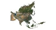
In addition to the 3D terrain of the Asia, you get a map of heights, a map of normals, satellite textures and other maps.
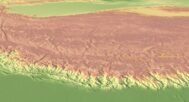
Height Map

You can use this map in the displacement channel instead of the polygonal mesh.
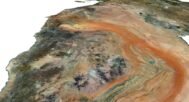
Normal Map

Use this map to reveal fine details of the relief.
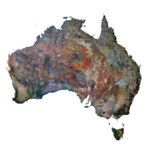
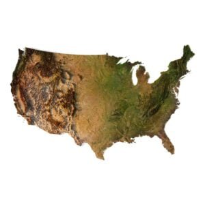
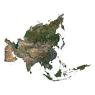
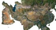
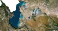
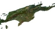
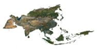
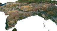
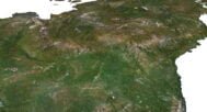
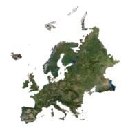
Satellite image

The satellite texture is high resolution in TIF format.
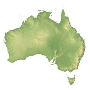
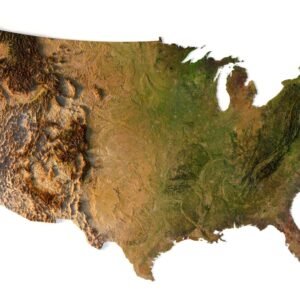
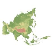
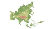
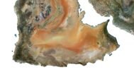
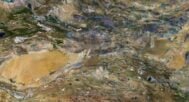
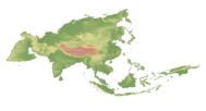
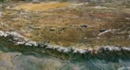
Pseudo-color Map

Use this map to get elevation information based on the color shade.
Boundary Mask

Use this map as a mask for your background.
Have a Question?
Do you need Shapefile?
Do you need more resolution satellite images?
Do you need a 3D model in BLEND, OBJ or FBX format?
Related products