
Africa 3D Model
$28.00
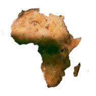
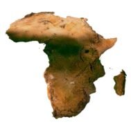
Africa 3D Model – Detailed Digital Representation of the African Continent
![]()
3D model
- Format: C4D (export to OBJ/FBX on request)
- File size: 795 MB
- Polygons: 16 679 860
- Vertices: 8 355 327
- Geometry: Polygonal Tris only
- Model size: 988.8 mm x 857.6 mm x 6.007 mm
- Projection: Mercator
- Base: Open
Textures
- Format: TIF
- File size: 221 MB
- Resolution: 6000*6000*24b
- Type: Multi-layer (you can easily change the texture in Photoshop)
- UV layer: yes
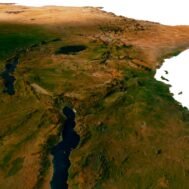
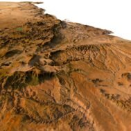
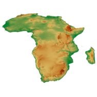
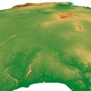
Bring the vast and diverse landscapes of Africa into your project with our highly detailed Africa 3D model. Perfect for terrain representation, geographical modeling, and virtual exploration, this model offers an accurate portrayal of the continent’s unique features, from its mountains to its coastlines.
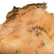
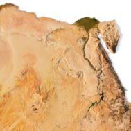
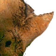
Accurate Terrain and Topographic Mapping
Our 3D mapping technology ensures precise topographic mapping of the African continent, providing an intricate look at elevations, valleys, and plains. Ideal for projects that require detailed landscape design and environmental modeling, this model is crafted to reflect the continent’s true natural diversity.
Ideal for Virtual Exploration and Cultural Landmark Integration
This Africa 3D model is not just about geography—it’s a perfect tool for virtual exploration and the integration of cultural landmarks. Use it in applications where you need an immersive experience, whether for educational purposes or digital presentations.
Versatile Applications for Digital Geography and Beyond
Whether you’re working in digital geography, architectural planning, or media production, our Africa 3D model fits various use cases, offering a versatile platform for rendering landscapes, creating interactive environments, and visualizing continent-wide data.

In addition, I can attach a map of heights, shape-files and various satellite textures.
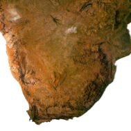
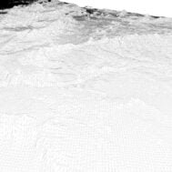
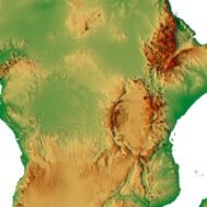
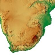
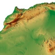
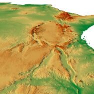
Africa DEM

The elevation map is used to get information about low and high parts of the Africa relief.
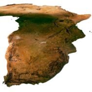
Shapefile of Africa

The shapefile is used to cut the 3D map along the contour.
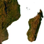
Satellite image of Africa

The satellite texture is high resolution in TIF format.
Have a Question?
Do you need Shapefile of Africa and regions?
Do you need more resolution satellite Africa images?
Do you need a 3D models of Africa in BLEND, OBJ or FBX format?