
World Map Dymaxion 3D Model
$28.00
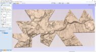
Dymaxion World Map – Fuller Projection 3D Model
![]()
![]()
3D models
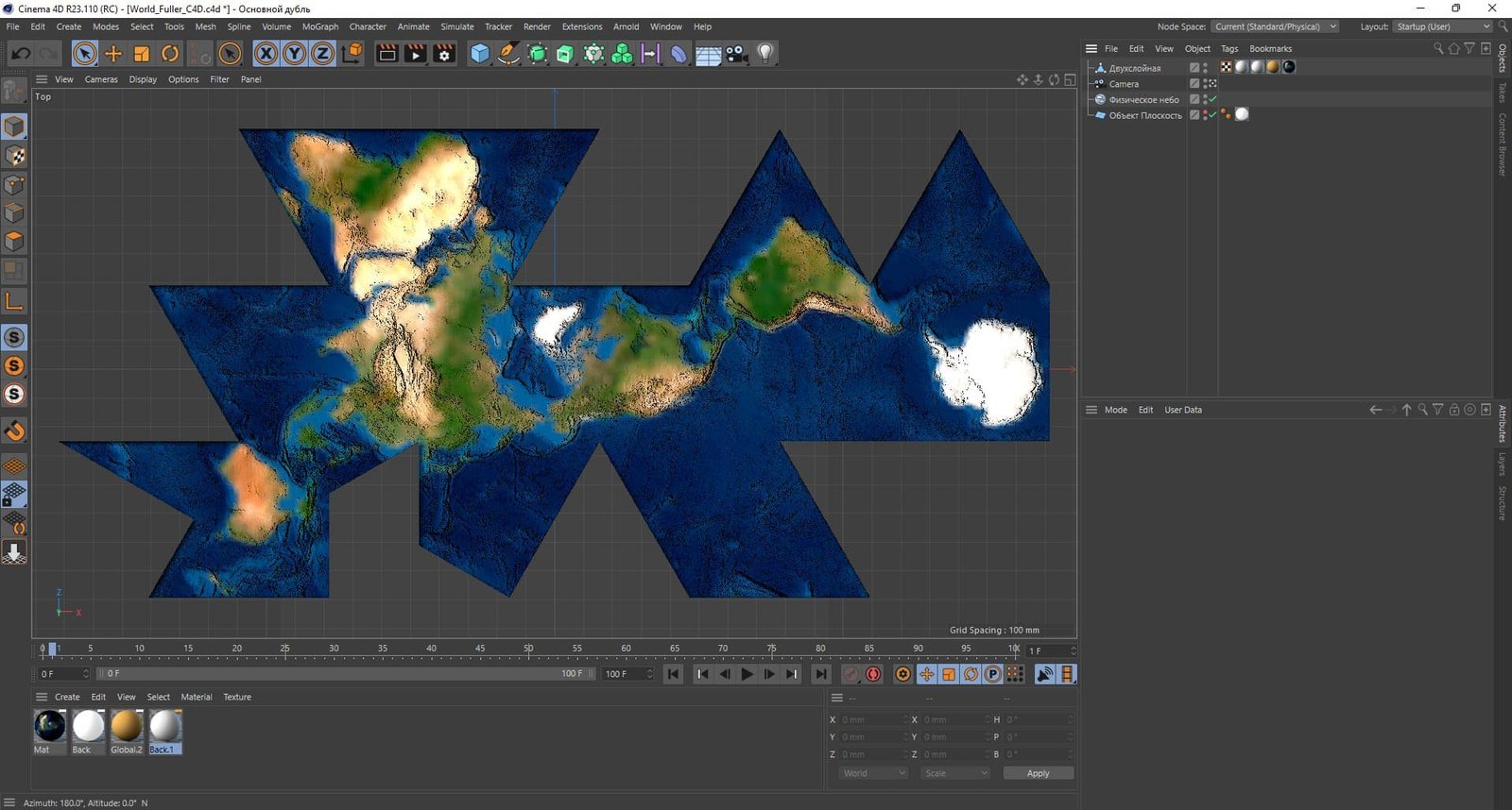
- Format: OBJ (LOD1/LOD2/LOD3)/STL
- File size: 1.6 GB/900 MB/350 MB/ 756 MB
- Polygons: 15 073 402/ 8 000 000 /1 600 000
- Geometry: Polygonal Tris only
- Model size: 344 mm x 162 mm x 5 mm
- Base: Open
Textures
- Format: TIF
- File size: 131 MB
- Resolution: 6000*6000*24b
- UV layer: yes
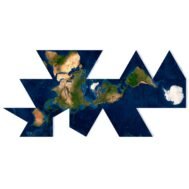
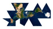
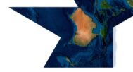
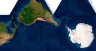
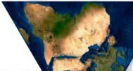
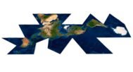
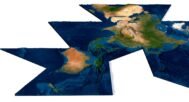
Experience the world in a completely new way with the Dymaxion World Map, designed using Buckminster Fuller’s revolutionary Fuller Projection. This 3D model presents the Earth’s landmasses and continents in an unfolded view, minimizing distortion compared to traditional maps. Ideal for educational, professional, and design purposes, the Dymaxion projection offers a unique perspective on global mapping.
A Revolutionary Approach to Cartography
The Dymaxion Projection Map is based on geodesic principles and offers a seamless view of the Earth’s surface. Unlike traditional projections, which distort the shapes and sizes of continents, the Dymaxion World Map displays them with greater accuracy. This unique projection is ideal for understanding the true relationships between landmasses without the distortions common in flat maps or globes.
Buckminster Fuller’s Vision in 3D
Designed by Buckminster Fuller, the Dymaxion World Map represents his vision of creating a world map that better reflects the actual geography of the Earth. By using a geodesic structure, Fuller’s map reduces distortion, allowing for a more accurate and insightful view of the planet. This 3D model captures that vision, making it perfect for cartography enthusiasts and geography educators alike.
Explore the Airocean World Map with Unfolded Accuracy
The Airocean World Map, another name for the Dymaxion Projection, allows you to visualize the planet in an unfolded state, offering insights into the true distribution of continents and oceans. This projection minimizes the warping and inaccuracies of traditional map projections, making it a superior tool for global mapping and geographic analysis.
Key Features of the Dymaxion World Map 3D Model
- Fuller Projection with minimal distortion of Earth’s landmasses
- Unique geodesic design by Buckminster Fuller
- Accurate representation of continents and their relationships
- Ideal for educational use, design projects, and advanced cartography
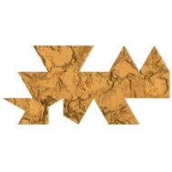
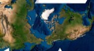
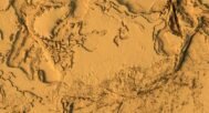
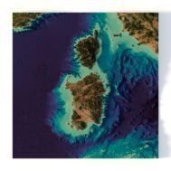
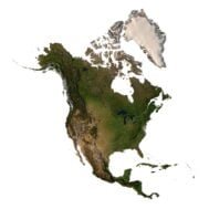
In addition to the 3D terrain model of the World, I can attach a map of heights and various satellite textures.
World Map in Dymaxion Projection DEM

The elevation map is used to get information about low and high parts of the World relief.
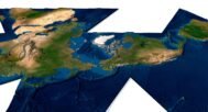
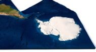
Satellite image of World in Dymaxion Projection

The satellite texture is high resolution in TIF format.
Have a Question?
Do you need more resolution satellite World in Dymaxion Projection images?
Do you need a 3D models of the World in Dymaxion Projection in BLEND, OBJ or FBX format?