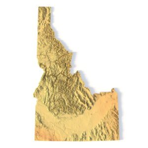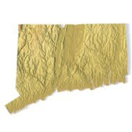
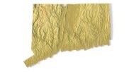
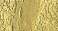
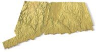

Connecticut Topographic Map STL – 3D Terrain Model for 3D Printing & CNC
Original price was: $21.00.$15.00Current price is: $15.00.
![]()
- File size: 77.9 MB
- Model size: 185.8003 mm x 152.6001 mm x 3.414 mm
- Projection: Lambert conformal conic
- Scaling factor: X — 1; Y — 1; Z — 3
- Polygons: 1 634 748
- Vertices: 817 550
- Geometry: Polygonal Tris only
- Base: Closed
Connecticut Topographic Map STL – High-Resolution 3D Terrain Model
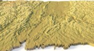
Connecticut Topographic Map STL is a high-detail 3D terrain model created from accurate elevation data and designed for 3D printing, CNC carving, and laser engraving. The model precisely represents the varied relief of Connecticut, including coastal lowlands, river valleys, rolling hills, and upland terrain, making it suitable for professional, educational, and creative applications.
This Connecticut terrain STL model is supplied in standard STL format and is fully compatible with FDM and SLA 3D printers, as well as CNC routers and milling machines. Optimized polygonal geometry combined with enhanced vertical scaling provides clear, readable relief and realistic terrain depth in physical topographic maps.
Key Features of the Connecticut Terrain STL Model
- High-detail Connecticut topographic map STL
- Accurate digital elevation model (DEM)
- Optimized for 3D printing (FDM / SLA)
- Ready for CNC carving and milling
- Suitable for laser engraving
- Mercator projection for consistent geometry
- Triangle-only polygonal mesh
- Open or closed base configuration
Applications of the Connecticut 3D Topographic Map
This Connecticut 3D terrain model can be used in a wide range of applications:
- Raised topographic relief maps
- CNC-carved wooden or metal terrain models
- Educational geography and geology projects
- Landscape and terrain visualization
- Museum exhibits and presentation models
- Decorative wall maps and interior design elements
Whether you are producing a 3D printed Connecticut map, a CNC terrain model, or a laser-engraved relief, this STL file ensures professional accuracy and high visual quality.