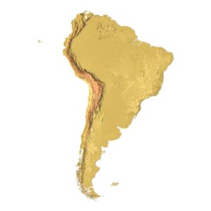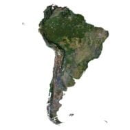
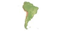
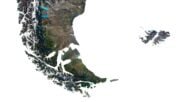
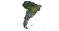
South America 3D Model Terrain
$35.00
South America 3D Model – High-Resolution Topographic Map
![]()
3D model
- Format: C4D (export to OBJ/FBX on request)
- File size (unzipped): 571 MB
- Polygons: 4 999 359
- Vertices: 9 989 680
- Geometry: Polygonal Tris only
- Model size: 1000 mm x 1475 mm x 4.995 mm
- Projection: Mercator
- Base: Open
- UV layer: Yes (frontal)
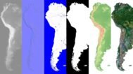
Textures
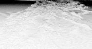
- Height Map TIF 6110*8193*16b – You can use this map in the displacement channel instead of the polygonal mesh.
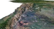
- Normal Map TIF 6110*8193*48b – Use this map to reveal fine details of the relief.
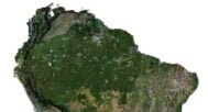
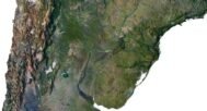
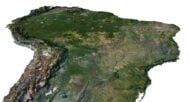
- Satellite Map TIF 8800*8193*48b
- Water Mask TIF 8193*11800*48b – Use this map for masking in the Reflection channel to get glare from the water surface.
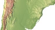
- Pseudo-color Map 8193*11800*48b – Use this map to get elevation information based on the color shade.
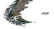
- Boundary Mask TIF 8193*11800*48b – Use this map as a mask for your background.
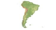
The South America 3D Model is an exceptionally detailed and accurate 3D representation of the continent’s diverse topography. Whether you’re working in geography, 3D cartography, or virtual reality, this model provides the precise and rich details you need.
Key Features of the South America 3D Model
Our 3D model captures the intricate features of South America, including:
- Mountains, such as the Andes, and other geographical landmarks.
- Valleys, plains, and other terrains across the continent.
- Detailed rivers, lakes, and coastlines.
Built with Advanced Data Sources
This model was developed using cutting-edge satellite imagery and topographical surveys, processed to create an incredibly realistic and highly accurate digital elevation model. The high resolution allows for fine details, making this product perfect for terrain modeling and interactive mapping.
Applications of the South America 3D Model
Ideal for professionals in geospatial analysis, landscape simulation, and cartographic representation, the South America 3D model is suitable for use in:
- 3D graphic design projects requiring accurate topography.
- Virtual reality terrain simulations for education and research.
- Interactive maps for presentations or development.
This model is versatile and essential for anyone needing a precise, scalable, and adaptable map of South America.

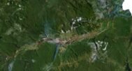
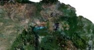
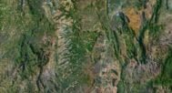
In addition to the 3D terrain of the South America, you get a map of heights, a map of normals, satellite textures and other maps.
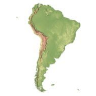
Height Map

You can use this map in the displacement channel instead of the polygonal mesh.
Normal Map

Use this map to reveal fine details of the relief.
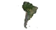
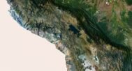
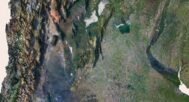
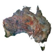
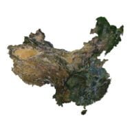
Satellite image

The satellite texture is high resolution in TIF format.
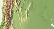
Pseudo-color Map

Use this map to get elevation information based on the color shade.
Water Mask

Use this map for masking in the Reflection channel to get glare from the water surface.
Have a Question?
Do you need Shapefile?
Do you need more resolution satellite images?
Do you need a 3D model in BLEND, OBJ or FBX format?