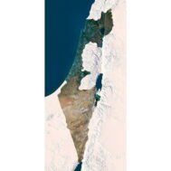
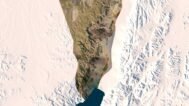
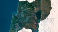
Israel 3D Map
$32.00
High-resolution Israel 3D Map in TIF format
![]()
- Linear size: 58 x 121 cm
- Pixel resolution: 98 MPx (6 850 px x 14 350 px)
- File size: ~700 MB
- Compression: No compression
- Color Depth: 16 Bit/channel
- Color model: RGB
- Print resolution: 300 DPI
- Projection: Mercator
The Israel 3D Map is a high-resolution TIF terrain map render capturing Israel’s landscapes with exceptional detail. Perfect for Israel topographic map render, 3D visualization, educational projects, and home or office decor.
From the rolling hills of Galilee to the majestic Negev Desert and the serene Mediterranean coastline, this high-resolution Israel 3D map brings every hill, valley, and shoreline to life. Each feature is meticulously modeled using accurate geographical data, making this map both a visual masterpiece and an educational resource.
Key Features:
✔ High-Resolution Terrain Map: 98 MPx (6,850 × 14,350 px), 16-bit RGB, print-ready at 300 DPI.
✔ Israel 3D Map Render: Optimized for digital display, printing on photo paper, metal, acrylic, or walls.
✔ Israel Topographic Map Render: Accurate relief and landscape modeling.
✔ Educational & Decor Use: Ideal for classrooms, travel planning, or elegant wall art.
✔ Projection: Mercator – preserves real-world geographic relationships.

Sample Uses:
Use as a 3D rendering reference for design and visualization projects.
Print as a large wall poster showcasing Israel’s diverse terrains.
Integrate into geography lessons for students of all ages.
Plan your travels across Israel with precise terrain mapping.
Decorate homes or offices with a high-resolution Israel landscape map.
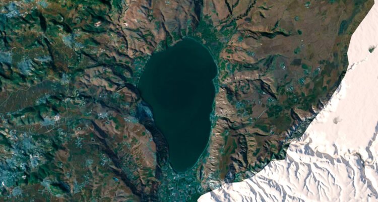
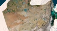
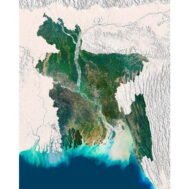
Israel 3D Map at 100% zoom (Click to zoom in)