
Hawaii Terrain 3D model
$28.00
![]()
![]()
3D models
- Format: C4D
- File size (unzipped): 872 MB
- Polygons: 15 236 320
- Vertices: 7 641 528
- Geometry: Polygonal Tris only
- Model size: 605.648 mm x 393.1 mm x 10.774 mm
- Projection: Mercator
- Base: Open
- UV layer: Yes (frontal)
Added OBJ files with different Levels Of Detail (LOD)
- OBJ: LOD100/LOD50/LOD25
- Files size: 1.17 GB/889 MB/438 MB
- Polygons: 15 236 320/7 618 160/3 809 080
Textures
- Format: TIF
- File size: 39.5 MB
- Resolution: 10000*10000*48b
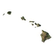
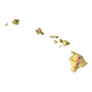
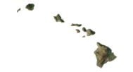
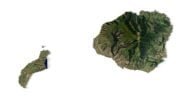
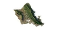
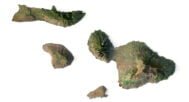
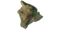
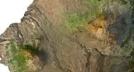
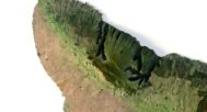
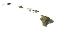
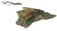
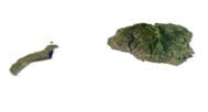
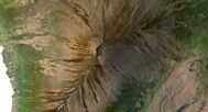
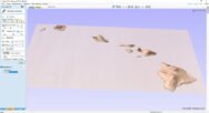
The Hawaii Terrain 3D model is a detailed and accurate representation of the topographical features of the state of Hawaii. It includes the islands of Hawaii, Maui, Oahu, and Kauai, as well as their surrounding waters and coastal features. The model has been created using high-resolution elevation data and satellite imagery, ensuring that it is highly accurate and realistic.
The model can be used for a variety of purposes, including graphic design, printing on a 3D printer, and milling on a CNC machine. It can be used for creating visualizations and animations.
The Hawaii Terrain 3D model is available in a variety of file formats, including STL, OBJ, and FBX, making it compatible with a wide range of software and hardware. It is also available in a variety of resolutions, from low-resolution models suitable for animation and visualization to high-resolution models suitable for printing and milling.
In addition to the 3D terrain model of Hawaii, I can attach a map of heights, shape-files and various satellite textures.
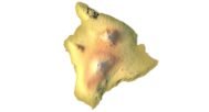
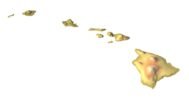
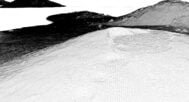
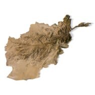
Hawaii DEM

The elevation map is used to get information about low and high parts of the Hawaii relief.
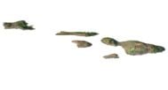
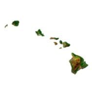
Shapefile of Hawaii

The shapefile is used to cut along the contour.
Satellite image of Hawaii
The satellite texture is high resolution in TIF format.
Have a Question?
Do you need Shapefile?
Do you need more resolution satellite images?
Do you need a 3D model in BLEND, OBJ or FBX format?