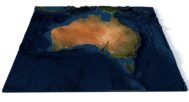
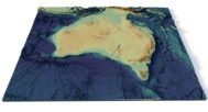
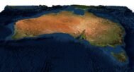

Australia terrain 3D model
$28.00
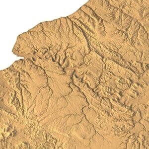
Australia Terrain 3D Model: Precision in Every Landscape
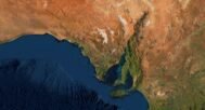
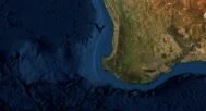
![]()
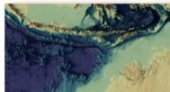
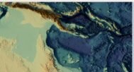
3D model
- Format: C4D (export to OBJ/FBX on request)
- File size: 575 MB
- Polygons: 21 539 912
- Vertices: 10 776 595
- Geometry: Polygonal Tris only
- Model size: 710.218 mm x 592.542 mm x 28.528 mm
- Projection: Mercator
- Base: Open
Textures
- Format: TIF
- File size: 56 MB
- Resolution: 7000*6000*32b
- UV layer: no
Discover the detailed and accurate 3D model of Australia’s terrain, designed to provide a realistic representation of the continent’s diverse landforms. Ideal for professionals in cartography, environmental studies, and design, this model offers topographical accuracy and versatility for various applications.
High-Detail Australian Terrain Model for Visualization and Analysis
Our Australia terrain 3D model uses cutting-edge geospatial data to deliver precise elevation mapping and landform representation. Whether you’re visualizing Australia’s topography for environmental simulations or conducting a cartographic analysis, this model delivers exceptional detail and usability.
Applications of the Australian Terrain 3D Model
- Professional Use
From geospatial data visualization to elevation mapping, this 3D model offers unmatched detail, making it ideal for terrain visualization and environmental simulation in various fields. - Educational Tool
Perfect for educators and students, the model brings topographical features to life, allowing for an engaging way to study Australian terrain and its natural formations. - Custom Projects
Ideal for integrating into presentations, videos, and 3D landscapes for professional design projects, enhancing the clarity and depth of topographic features.
Why Choose Our 3D Terrain Model of Australia?
This digital elevation model offers high accuracy, perfect for everything from environmental studies to custom design work. Whether you’re a geographer, designer, or educator, this 3D model is a versatile and valuable tool for representing Australia’s diverse landscapes.

In addition to the 3D terrain model of Australia, I can attach a map of heights, shape-files and various satellite textures.
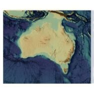
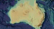
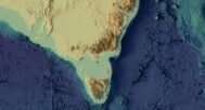
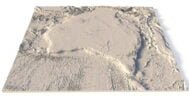
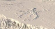
Australia DEM

The elevation map is used to get information about low and high parts of the Australia relief.
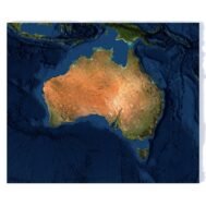
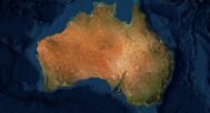
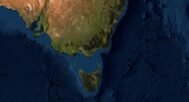
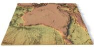
Satellite image of Australia
The satellite texture is high resolution in TIF format.
Have a Question?
Do you need Shapefile of Australia and regions?
Do you need more resolution satellite Australia images?
Do you need a 3D model of Australia in BLEND, OBJ or FBX format?