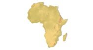
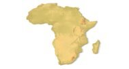


Africa Topographic Map STL – 3D Terrain Model for 3D Printing & CNC
$21.00
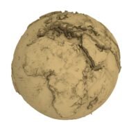
![]()
- File size: 88.8 MB
- Model size: 760 mm x 850 mm x 7.8 mm
- Projection: Mercator
- Scaling factor: X — 0,001; Y — 0,001; Z — 0,015
- Polygons: 1 862 794
- Vertices: 931 711
- Geometry: Polygonal Tris only
- Base: Closed
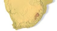
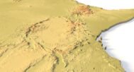
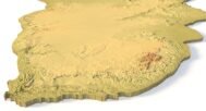
Africa topographic map STL is a high-resolution 3D terrain model of the African continent designed for 3D printing, CNC carving, and laser engraving. This detailed Africa terrain STL accurately represents elevation, landforms, and relief, making it suitable for professional, educational, and creative applications.
The model is based on a precise digital elevation model (DEM) and optimized for manufacturing workflows. Whether you are producing a 3D relief map of Africa, a wooden CNC map, or a large-scale terrain visualization, this STL file delivers clean geometry and reliable results.
Applications of the Africa 3D Terrain STL Model
- 3D Printing (FDM / SLA)
Print a physical Africa relief map with clearly defined elevation differences. Ideal for educational models, wall art, and exhibitions. - CNC Machining
Use this Africa CNC terrain model for carving in wood, MDF, plastic, or soft metals. Suitable for large-format CNC routers. - Laser Engraving & Relief Art
Create engraved or shallow-relief representations of Africa’s topography for decorative or presentation purposes.
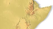
Accurate Africa Terrain and Elevation Data
This Africa terrain STL captures major mountain systems, plateaus, deserts, and lowlands with enhanced vertical exaggeration for visual clarity. The model is ideal for:
- geography and geology education
- museum and classroom displays
- designers and architects working with geographic forms
- makers creating custom wooden or metal 3D maps


Why Choose This Africa Topo Map STL?
If you are looking for a professional Africa 3D map STL for physical production, this model offers an optimal balance of detail, file size, and manufacturability. It is ready to use out of the box and can be easily customized for different sizes, projections, or base thicknesses.
Download the Africa topographic map STL and bring the continent’s terrain to life in 3D.