Blog
Where is Iceland on the Map?
Introduction
Iceland, often called the “Land of Fire and Ice,” is a country known for its breathtaking landscapes, including volcanoes, geysers, glaciers, and hot springs. Located in the North Atlantic Ocean, Iceland’s unique geographical position and natural beauty make it a fascinating destination for travelers and geographers alike. In this article, we will explore Iceland’s location on the map, its geographic features, historical context, and cultural significance.
Geographic Location of Iceland
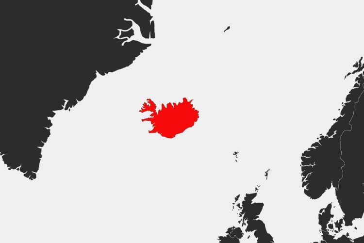
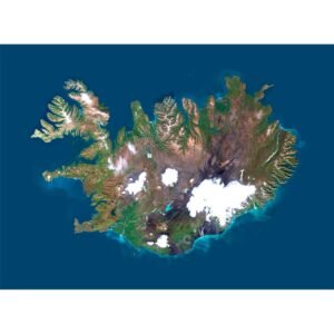
Iceland is an island nation situated in the North Atlantic Ocean, lying just below the Arctic Circle. Its coordinates are approximately 63° to 67° north latitude and 18° to 23° west longitude. Despite its northerly location, Iceland benefits from the Gulf Stream, which moderates its climate, making it more temperate than might be expected for a country so close to the Arctic.
[mapsvg id=”9″]
Proximity to Other Countries
Iceland is located about 1,000 kilometers (620 miles) west of Norway, 800 kilometers (500 miles) southeast of Greenland, and 1,500 kilometers (930 miles) from Scotland. Its isolated position in the North Atlantic has contributed to its unique culture and natural environment, largely untouched by the influences of mainland Europe.
Major Cities and Regions
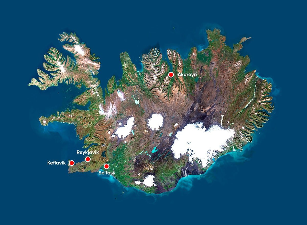
Iceland is divided into several regions, each with distinct geographical and cultural characteristics. The major cities include:
- Reykjavik: The capital and largest city of Iceland, Reykjavik is located in the southwestern part of the country. It is the northernmost capital of a sovereign state in the world and serves as the cultural and economic hub of Iceland.
- Akureyri: Known as the “Capital of the North,” Akureyri is Iceland’s second-largest city, located on the northern coast. It is a key center for fishing, agriculture, and tourism.
- Selfoss: A town in southern Iceland, Selfoss is an important agricultural and commercial center, located near some of the country’s most famous natural attractions, such as the Gullfoss waterfall and the Geysir hot springs.
- Keflavik: Situated near the country’s main international airport, Keflavik is a gateway for travelers and an important part of the Reykjanes Peninsula, known for its volcanic activity.
Unique Geographical Features
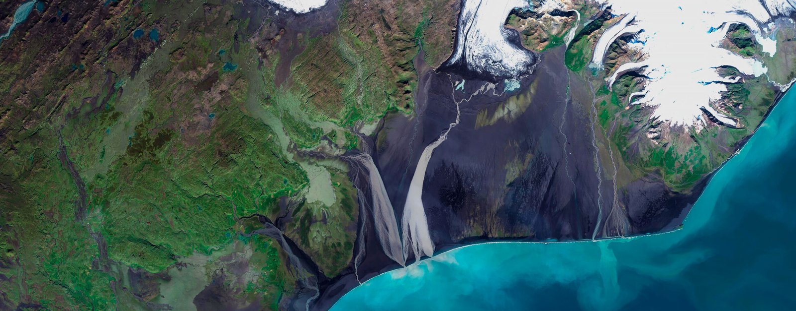
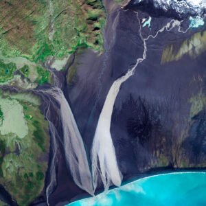
Iceland’s landscape is characterized by a stark contrast between fire and ice, with volcanic activity and glaciers shaping its terrain. Some of the country’s most notable geographical features include:
- Vatnajökull Glacier: The largest glacier in Iceland and one of the largest in Europe, Vatnajökull covers about 8% of the country’s land area. It is the centerpiece of Vatnajökull National Park, a UNESCO World Heritage site.
- Eyjafjallajökull Volcano: This glacier-covered volcano gained worldwide attention in 2010 when its eruption disrupted air travel across Europe. It is one of many active volcanoes in Iceland, contributing to the country’s dynamic geology.
- Thingvellir National Park: Located in southwestern Iceland, Thingvellir is a site of great historical and geological significance. It sits on the boundary between the North American and Eurasian tectonic plates, making it a prime location for observing the effects of plate tectonics.
- The Blue Lagoon: A famous geothermal spa located in the Reykjanes Peninsula, the Blue Lagoon is a popular destination for visitors seeking relaxation in its warm, mineral-rich waters.


Historical Context
Iceland’s history is closely tied to its geography, with its remote location shaping its development and culture. The country was settled by Norse explorers in the 9th century, and its history is marked by a blend of isolation and interaction with neighboring regions.
Settlement and the Commonwealth Era
Iceland was first settled by Norsemen from Scandinavia around 874 AD. The early settlers established a society based on clan systems and founded the Althing, one of the world’s oldest parliamentary institutions, in 930 AD. The Commonwealth period, which lasted until 1262, was characterized by the absence of a central authority and a reliance on law and consensus.
Union with Norway and Denmark
In 1262, Iceland entered into a union with Norway, which later became part of the Kalmar Union with Denmark. Iceland remained under Danish rule for several centuries, during which it experienced economic hardship, volcanic eruptions, and plagues. However, the country maintained its distinct culture and language.
Independence and Modern Era
Iceland began its path to independence in the 19th century, gaining sovereignty from Denmark in 1918 and fully becoming an independent republic in 1944. Since then, Iceland has developed into a modern, democratic state with a high standard of living and a strong emphasis on environmental sustainability.
Cultural Significance
Iceland’s culture is deeply rooted in its Norse heritage, with a strong tradition of literature, folklore, and a close connection to nature. The country’s cultural identity is reflected in its language, arts, and daily life.
Language and Literature
Icelandic, the official language, is a direct descendant of Old Norse and has changed little over the centuries. This has allowed Icelanders to read medieval texts, such as the famous sagas, in their original form. These sagas, which recount the lives and deeds of early settlers and heroes, are central to Icelandic culture and identity.
Festivals and Traditions
Icelanders celebrate a variety of festivals that reflect their historical and cultural heritage. Þorrablót, a midwinter festival, involves the consumption of traditional foods, while National Day on June 17th marks the country’s independence. The Iceland Airwaves music festival, held annually in Reykjavik, showcases both local and international talent.
Cuisine
Icelandic cuisine is influenced by the country’s natural resources, with seafood playing a central role. Dishes like hákarl (fermented shark) and skyr (a type of yogurt) are traditional staples, while modern Icelandic cuisine incorporates global influences.
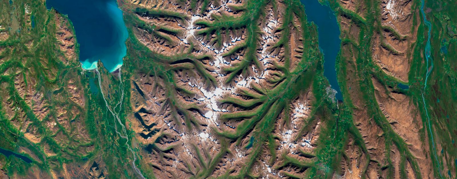
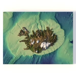
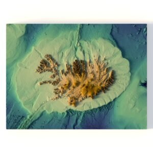
Maps and Visual Representations
Understanding Iceland’s geographical location and natural features is enhanced by high-resolution maps and 3D models. These resources provide detailed views of the country’s terrain and natural landmarks.


Conclusion
Iceland’s unique position on the map, coupled with its dramatic landscapes and rich cultural heritage, make it a country of immense interest. Whether exploring its volcanic terrain, soaking in geothermal spas, or delving into its Viking past, Iceland offers a wealth of experiences for all who visit.