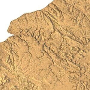
Grand Canyon 3D model
Original price was: $30.00.$20.00Current price is: $20.00.
Grand Canyon 3D Model – Detailed and Accurate Representation
![]()
![]()
3D model
- Format: C4D, STL
- File size: C4D (1.06 GB), STL (904 MB)
- Polygons: 18 973 050
- Vertices: 9 492 812
- Geometry: Polygonal Tris only
- Model size: 377.899 mm x 250.7 mm x 9.523 mm
- Projection: Mercator
- Base: Open
Textures
- Format: TIF
- File size: 320 MB
- Resolution: 6000*6000*48b
- UV layer: yes
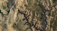
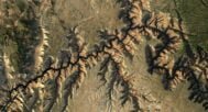
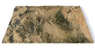
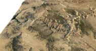
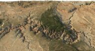
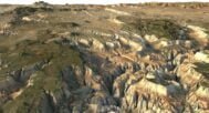
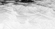
Our Grand Canyon 3D Model provides a highly detailed, accurate representation of one of the world’s most iconic landforms. This model captures the unique topography and structure of the canyon, making it ideal for educational purposes, professional landscape modeling, and visual presentations.
Why Choose Our Grand Canyon 3D Model?
Our 3D model offers unparalleled accuracy and precision, making it perfect for anyone interested in the Grand Canyon’s topography. Whether you’re studying erosion patterns or exploring the natural monument‘s vast landscapes, this model provides the depth of detail needed.
Perfect for Topography Studies and Landscape Modeling
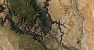
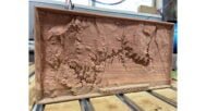
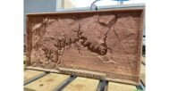
This 3D Grand Canyon model highlights the canyon’s impressive landscape, offering a visually rich depiction of its cliffs, ridges, and valleys. Ideal for professionals in the fields of landscape modeling and geography, the model emphasizes the effects of natural erosion on the canyon’s structure.
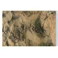
Topography and Structure of the Grand Canyon in 3D
Explore the intricate topography of the Grand Canyon, featuring its vast ridges, valleys, and cliffs. This model meticulously replicates the canyon structure, allowing users to understand the complex landscape of this natural wonder.
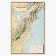
Grand Canyon 3D Map for Enhanced Visualization
For added versatility, our Grand Canyon 3D map showcases the entire area with fine attention to detail, offering an interactive view of this natural monument. It’s perfect for presentations, teaching aids, and simulations in both educational and professional settings.
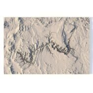
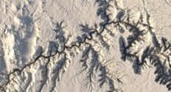
Grand Canyon DEM

The elevation map is used to get information about low and high parts of relief.
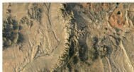
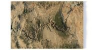
Grand Canyon Texture

Texture is high resolution in TIF format.
Have a Question?
Do you need more resolution satellite images?
Do you need a 3D map in BLEND, OBJ or FBX format?