Solar System
 World
World Continents
 Peninsulas
 Islands
 Countries
 States of America
 Canadian Provinces
 Parks & Canyons
 Fantasy
 Other
Other Planets
 Satellites


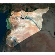
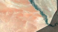
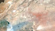
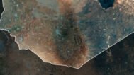
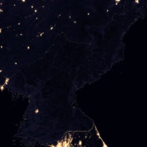
Syria Satellite Map
$15.00
Buy Syria Satellite Map – Ideal for Education, Decor, and Gifts
- Format: TIF
- Resolution: 9379*8279 px
- Depth: 24 bit
- Size: 106 MB
- Color scheme: RGB
- Projection: Mercator
Syria Satellite Map – High-Resolution Imagery for Multiple Uses
The Syria Satellite Map offers a high-resolution view of Syria’s geography, making it perfect for various applications. Whether you’re an educator, designer, or geography enthusiast, this detailed map provides insights into Syria’s landscape, land use, and topography. Ideal for educational purposes, interior design, or professional projects, this map is a versatile tool for anyone looking to understand Syria from above.
Educational Use of Syria Satellite Map
This satellite map of Syria is a valuable resource for teaching geography, geology, and environmental science. With detailed satellite imagery, students can examine Syria’s landforms, urban development, and natural features. By integrating this mapping technology into your lessons, you’ll help students visualize concepts like land use and topographical changes. The map is perfect for use in classrooms, lectures, and presentations.
Decorative Use for Homes and Offices
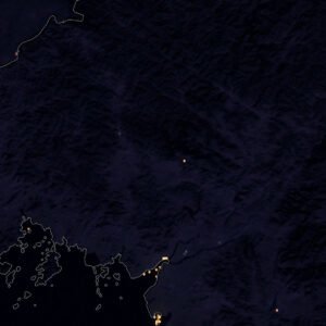
Transform your space with the Syria Satellite Map, a visually striking addition that brings sophistication to any room. Its detailed aerial view highlights Syria’s cities, mountains, and deserts, making it an ideal piece for framing. Whether you want to enhance your home, office, or classroom, this map serves as both a functional and decorative element. Its modern aesthetic can complement a wide range of interior styles.
Custom Projects and Presentations
If you’re working on a project that requires a detailed view of Syria’s landscape, this Syria satellite map can be easily integrated into your design. Perfect for use in posters, digital presentations, and reports, the high-resolution imagery provides clarity and precision. It’s also an excellent resource for custom projects related to remote sensing, military operations, and analysis of conflict zones.
A Unique Gift for Geography Lovers
Looking for a thoughtful and original gift? The Syria Satellite Map is a perfect choice for cartography enthusiasts, travelers, or anyone who appreciates the beauty of detailed geographic imagery. This map provides a unique perspective on Syria’s landscape and serves as a meaningful present for those who love exploring the world through maps.
FAQ
This map is not geo-referenced, but feel free to contact us to obtain a file with geo data if needed.
Yes, we offer custom projections upon request. Contact us for details.
Yes, if you need the map in a different file format, please contact us. We offer various formats to meet your needs.
Yes, of course. Please specify the desired 3D model format, dimensions and how you will use it. This will help me to prepare an optimal model for you.
Absolutely! If you require a higher resolution version, just let us know, and we can provide a version that fits your requirements.
Yes, we can customize the map with different projections or remove boundaries as needed. Please reach out to us with your specifications, and we’ll accommodate your request.
For custom sizes or additional features, please contact us directly. We are happy to work with you to create a tailored map that fits your specific needs.
Absolutely! The map is available in high resolution, making it suitable for large format printing without losing detail. Be sure to check with your printing company if they require RGB-to-CMYK color conversion for best results.
In addition to educational and decorative uses, the map can be utilized for trip planning, natural resource research, and as a creative gift.
Related products