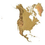
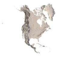
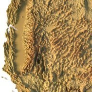
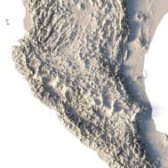

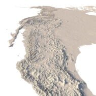


North America 3D Topographic Map STL Model – Lambert Conformal Conic Projection
$21.00
![]()
- File size: 235 MB
- Polygons: 4 942 306
- Vertices: 2 472 183
- Geometry: Polygonal Tris only
- Model size: 180 mm x 220 mm x 1.5 mm
- Projection: Lambert Conformal Conic
- Scaling factor X:Y:Z: 1:1:5
- Base: Closed
North America 3D Topographic Map STL Model
North America 3D topographic map STL model is a high-detail digital terrain model designed for 3D printing, CNC milling, and professional cartographic visualization. This STL map accurately represents the relief of the North American continent using the Lambert Conformal Conic projection, which is widely applied in geographic and educational mapping due to its shape-preserving properties across mid-latitudes.
The model features a closed base and enhanced vertical scale, making elevation changes clearly visible when printed or machined. It is suitable for creating physical relief maps, educational displays, architectural mockups, and artistic installations.
This North America STL model can be easily resized, smoothed, or simplified in Blender, Fusion 360, Meshmixer, or other 3D software. You may also adjust the base height, reduce polygon count, or add custom labels and borders.
Use Cases
- 3D printed North America relief map for education and geography classes
- CNC-milled wooden or metal terrain maps
- High-resolution laser-engraved topographic panels
- Master models for casting in concrete, resin, or foam
- Visual assets for presentations, exhibitions, and museums
If you need this North America 3D terrain model in a different size, resolution, or cartographic projection, custom modifications are available on request.