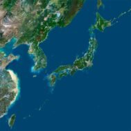
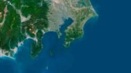
Japan Satellite Map
$15.00
Buy Japan Satellite Map – Ideal for Education, Decor, and Gifts
- Format: TIF
- Resolution: 15000*15000 px
- Depth: 24 bit
- Size: 200 MB
- Color scheme: RGB
- Projection: Mercator
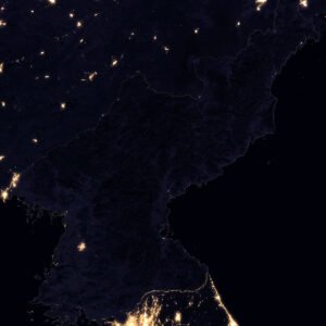
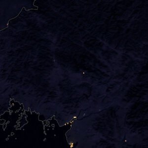
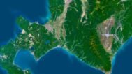
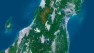
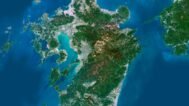
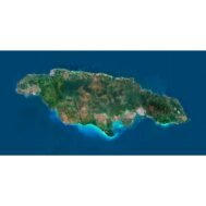
Experience the breathtaking landscapes of Japan like never before with our Japan Satellite Map. This meticulously designed digital map captures the intricate details of Japan’s diverse topography through high-resolution satellite imagery. Whether you are an educator, a designer, or a map enthusiast, this map delivers outstanding clarity and versatility for a wide range of applications.
Key Features:
High-Resolution Detail:
Our Japan Satellite Map offers exceptional resolution, allowing you to explore every detail of Japan’s geography. From the snow-capped peaks of the Japanese Alps to the bustling coastlines and volcanic landscapes, the map presents a vivid and accurate view of the nation’s natural beauty.
Versatile Applications:
Educational Tool: Perfect for teaching geography, geology, and environmental science. The detailed satellite images help students and researchers better understand Japan’s unique terrain, land use, and natural features.
Decorative Piece: Elevate any interior with a visually captivating map of Japan. Ideal for framing and display in homes, offices, classrooms, or cultural institutions.
Custom Projects: Easily incorporate the Japan satellite view into posters, digital designs, presentations, or multimedia projects. Its clarity ensures professional results at any scale.
Unique Gift: A meaningful and original present for travelers, Japan enthusiasts, or anyone who values detailed cartographic art.
Enhance your knowledge and appreciation of Japan with this extraordinary satellite map. With its precision, sharp detail, and multiple uses, it’s an invaluable resource for education, decoration, and creative projects. Bring a piece of Japan’s beauty into your life today.
FAQ
This map is not geo-referenced, but feel free to contact us to obtain a file with geo data if needed.
Yes, we offer custom projections upon request. Contact us for details.
Yes, if you need the map in a different file format, please contact us. We offer various formats to meet your needs.
Yes, of course. Please specify the desired 3D model format, dimensions and how you will use it. This will help me to prepare an optimal model for you.
Absolutely! If you require a higher resolution version, just let us know, and we can provide a version that fits your requirements.
Yes, we can customize the map with different projections or remove boundaries as needed. Please reach out to us with your specifications, and we’ll accommodate your request.
For custom sizes or additional features, please contact us directly. We are happy to work with you to create a tailored map that fits your specific needs.
Absolutely! The map is available in high resolution, making it suitable for large format printing without losing detail. Be sure to check with your printing company if they require RGB-to-CMYK color conversion for best results.
In addition to educational and decorative uses, the map can be utilized for trip planning, natural resource research, and as a creative gift.
Related products