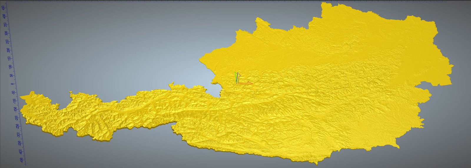
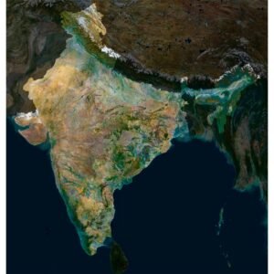
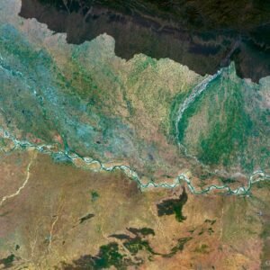
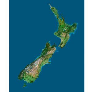
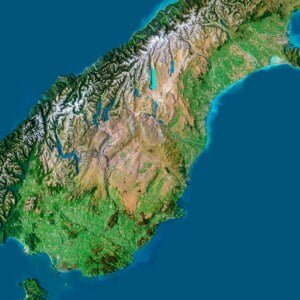
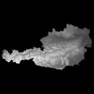
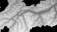
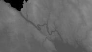
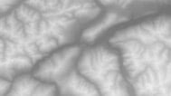
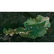
info@shustrik-maps.com

Contact me


    Free conversion to OBJ/FBX/STL/C4D
    • Services
    • About
    • FAQ
    • Site Map
    • How to buy?
    info@shustrik-maps.com

    Contact me


      Logo shustrik maps
      • 3D MODELSOBJ/FBX/C4D
        • Solar System

          3D MODELS OF SOLAR SYSTEM OBJECTS

          Planets (11)

          11 products

          Space objects (3)

          3 products
        • World

          World (6)

          6 products

          North Pole (1)

          1 product

          South Pole (1)

          1 product

          Fantasy (2)

          2 products
        • Continents

          North America (2)

          2 products

          South America (2)

          2 products

          Europe (2)

          2 products

          Asia (1)

          1 product

          Africa (2)

          2 products

          Oceania (3)

          3 products

          Antarctica (1)

          1 product
        • Peninsulas

          Peninsulas (1)

          1 product
        • Islands

          Islands (13)

          13 products
        • Countries

          All countries →

          3D MODELS OF THE COUNTRIES

          A | B | C | D | E | 

          F | G | H | I | J | 

          K | L | M | N | O | 

          P | Q | R | S | T | 

          U | V | W | Y | Z | 

          3D MODELS OF COUNTRIES BY CONTINENT

          NORTH AMERICA

          • Northern America
          • Central America
          • Caribbean

          SOUTH AMERICA

          EUROPE

          • Western Europe
          • Northern Europe
          • Southern Europe
          • Eastern Europe

          AFRICA

          • Eastern Africa
          • Middle Africa
          • Northern Africa
          • Southern Africa
          • Western Africa

          ASIA

          • Central Asia
          • Eastern Asia
          • Southeast Asia
          • Southern Asia
          • Western Asia
        • States of America

          All states →

          UNITED STATES 3D MODELS

          Alabama

          • C4D/OBJ/BLEND 
          • STL
          • Satellite Map

          Alaska

          • STL


          Arizona

          • C4D/OBJ/BLEND 
          • STL
          • Satellite Map

          Arkansas

          • C4D/OBJ/BLEND 
          • STL
          • Satellite Map

          California

          • Tex 1: C4D/OBJ
          • Tex 2: C4D/OBJ
          • STL
          • Satellite Map

          Colorado

          • C4D/OBJ/BLEND
          • STL
          • Satellite Map

          Connecticut

          • STL
          • Satellite Map

          Delaware

          • STL
          • Satellite Map

          Florida

          • C4D/OBJ/BLEND
          • STL
          • Satellite Map

          Georgia

          • STL
          • Satellite Map

          Hawaii

          • C4D/OBJ/BLEND
          • STL


          Idaho

          • C4D/OBJ/BLEND
          • STL
          • Satellite Map

          Illinois

          • STL
          • Satellite Map

          Indiana

          • C4D/OBJ/BLEND
          • STL
          • Satellite Map

          Iowa

          • C4D/OBJ/BLEND
          • STL
          • Satellite Map

          Kansas

          • C4D/OBJ/BLEND
          • STL
          • Satellite Map

          Kentucky

          • STL
          • Satellite Map

          Louisiana

          • STL
          • Satellite Map

          Maine

          • STL
          • Satellite Map

          Maryland

          • STL
          • Satellite Map

          Massachusetts

          • STL
          • Satellite Map

          Michigan

          • STL

          Minnesota

          • STL


          Mississippi

          • STL

          Missouri

          • STL

          Montana

          • Tex 1: C4D/OBJ
          • Tex 1: C4D/OBJ
          • STL

          Nebraska

          • C4D/OBJ/BLEND
          • STL


          Nevada

          • C4D/OBJ/BLEND
          • STL


          New Hampshire

          • STL


          New Jersey

          • STL

          New Mexico

          • C4D/OBJ/BLEND
          • STL

          New York

          • STL


          North Carolina

          • STL

          North Dakota

          • C4D/OBJ/BLEND
          • STL

          Ohio

          • STL


          Oklahoma

          • STL

          Oregon

          • C4D/OBJ/BLEND
          • STL

          Pennsylvania

          • STL


          Rhode Island

          • STL

          South Carolina

          • STL

          South Dakota

          • C4D/OBJ/BLEND
          • STL

          Tennessee

          • STL


          Texas

          • C4D/OBJ/BLEND
          • STL

          Utah

          • C4D/OBJ/BLEND
          • STL


          Vermont

          • STL


          Virginia

          • STL

          Washington

          • C4D/OBJ/BLEND
          • STL

          West Virginia

          • STL


          Wisconsin

          • STL

          Wyoming

          • C4D/OBJ/BLEND
          • STL
        • Canadian Provinces

          CANADIAN PROVINCES 3D MODELS

          Alberta

          British Columbia

          Manitoba

          New Brunswick

          Newfoundland

          Nova Scotia

          Ontario

          Prince Edward

          Quebec

          Saskatchewan

          CANADIAN TERRITORIES 3D MODELS

          Northwest Territories

          Nunavut

          Yukon

        • Parks & Canyons

          3D MODELS OF NATIONAL PARKS AND CANYONS

          Canyons (2)

          2 products
        • Other

          ART (5)

          5 products
      • 3D PRINT/CNC MODELSSTL
        • Planets
        • Satellites
        • Continents
        • Countries
        • Islands
        • States of America
        • Fantasy
        • Other
      • MAPSTIF/PSD/SVG
        • Satellite Maps
        • Night Satellite Map
        • Heightmaps/Raster DEM
        • Relief Maps
        • 3D Maps
        • Historical Maps
        • Outline Maps
      • FREE
      • SERVICES
      • A-Z
      Search
      0 items / $0.00
      Menu
      3D Models and 3D Maps
      0 items / $0.00
      Austria Height Map
      Austria HeightMap
      Austria Raster DEM
      Austria DEM
      Click to enlarge
      Austria Height Map
      Austria HeightMap
      Austria Raster DEM
      Austria DEM
      Home MAPS Heightmaps/Raster DEM Countries Austria Height Map
      Earth 3D model
      3D Model of Planet Earth $35.00
      Back to products
      High-resolution Austria satellite map displaying detailed topography.
      Austria Satellite Map $10.00

      Austria Height Map

      $15.00

      Austria Height Map – Elevation Map of Austria for 3D Modeling and Cartography.

      • Format: TIF
      • Resolution: 22227*11430 px
      • Depth: 32/16 bit
      • Size: 1.26 GB/484.6 MB
      • Grayscale: 0/1
      • Gamma Gray: 1.0
      • Compatible with GIS app: yes

      We accept VISA, Mastercard, ApplePay, GooglePay and other payment methods

      — OR —

      You can also purchase this product using MasterCard/Visa on
      RenderHub →  and 3Dexport →.

      SKU: SH_4442 Categories: Countries, Heightmaps/Raster DEM Tag: TIF
      Share:
      • Description
      Description

      Austria Height Map is a highly accurate map representing the detailed topography and elevation levels of Austria. This map is ideal for use in various fields such as 3D modeling, cartography, geographic research, and engineering design.

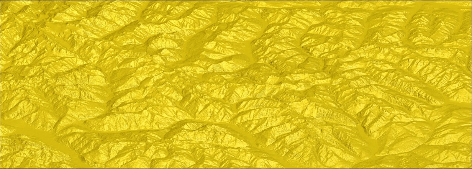
      What is a Height Map?

      A Height Map is a graphical representation of the terrain surface where different elevation levels are depicted by different shades of gray. The lighter the shade, the higher the elevation. These maps are widely used to create three-dimensional models of landscapes and other geographical features.

      Use Cases:

      1. 3D Modeling: Height maps allow for the creation of realistic 3D terrain models, useful in architecture, gaming, and film.
      2. Cartography: Elevation maps help in creating accurate topographic maps used in surveying and navigation.
      3. Geographic Research: Researchers can analyze terrain features, study geomorphological processes, and plan expeditions.
      4. Infrastructure Design: Engineers and planners can use height maps for planning and developing infrastructure projects such as roads, bridges, and buildings.
      5. Education: Height maps serve as excellent educational tools for students studying geography, geology, and related fields.

      Features:

      • High Resolution: The Austria Height Map features high resolution, ensuring precision and detail.
      • Compatibility: Suitable for use with various software packages for 3D modeling and GIS systems.
      • Extensive Coverage: Covers the entire territory of Austria, including major mountain ranges, valleys, and plains.

      Benefits:

      • Accurate Data: High precision data allows for detailed analysis and realistic modeling.
      • Ease of Use: The map integrates easily with popular software packages for further processing and visualization.
      • Versatility: A wide range of applications makes this map useful for professionals in various fields.

      By purchasing the Austria Height Map on shustrik-maps.com, you are getting a reliable tool for working with geographic data. This map will be an invaluable asset in your projects, providing high quality and accuracy.

      Related products

      Africa satellite map
      High-resolution satellite view showcasing Africa's diverse terrain and urban areas

      Africa Satellite Map

      $10.00
      Add to cart
      High-resolution Alabama satellite imagery displaying detailed topography and natural features.
      Alabama satellite map highlighting major rivers, mountain ranges, and geographical features.

      Alabama Satellite Map

      $15.00
      Add to cart
      China map
      China 3D map

      China 3D Map

      $32.00
      Add to cart
      India 3D map
      Satellite map of India

      India 3d map

      $32.00
      Add to cart
      New Zealand map
      Topographic map New Zealand

      New Zealand 3D Map

      $32.00
      Add to cart
      -50%
      Night satellite map North Korea
      Night satellite view of North Korea

      North Korea Night Satellite Map

      $10.00 Original price was: $10.00.$5.00Current price is: $5.00.
      Add to cart
      -50%
      Satellite picture of Korea at night
      Satellite picture of Korea at night with border

      Satellite Picture of Korea at Night

      $10.00 Original price was: $10.00.$5.00Current price is: $5.00.
      Add to cart
      United Kingdom 3D map
      United Kingdom map

      United Kingdom & Ireland 3d map

      $32.00
      Add to cart
      -50%
      United States night satellite image
      Night satellite view of USA

      United States Night Satellite Map

      $10.00 Original price was: $10.00.$5.00Current price is: $5.00.
      Add to cart
      Vietnam 3D map
      Vietnam terrain

      Vietnam 3D Map

      $32.00
      Add to cart
        INFO
        • About
        • Explore Our Terrain Services
        • Support
        • Shipping and delivery policy
        • Refund and Returns Policy
        • Privacy Policy
        • in**@***********ps.com
        • Blog
        How to buy
        • TERRAIN 3D MODELS FREE
        • Purchase with Crypto/PayPal/VISA
        • Buy on Cults3D.com
        • Buy on CGtrader.com
        • Buy on RenderHub.com
        • Buy on 3DExport.com
        • Discounts
        Buy 3D models
        • Planets
        • World
        • Continents
        • Peninsulas
        • Islands
        • Countries
        • States of America
        • Canadian Provinces
        • Canyons
        • Cities
        • Fantasy
        • Minecraft
        Buy 3D models for CNC
        • Planets
        • Continents
        • Islands
        • Countries
        • States of America

        DEM DSM DTM FBX OBJ STL

        SHUSTRIK-MAPS 2025
        • 3D MODELS
          • Solar System
          • World
          • Continents
          • Peninsulas
          • Islands
          • Countries
          • States of America
          • Canadian Provinces
          • Canyons
          • Buildings
          • Fantasy
          • ART
        • 3D PRINT/CNC MODELS
          • Planets
          • Satellites
          • Continents
          • Countries
          • Islands
          • States of America
          • Fantasy
          • Other
        • MAPS
        • A-Z
        • FREE
        • About
        • FAQ
        • How to buy?
        • Site Map HTML
        • Explore Our Terrain Services
        Shopping cart
        Close
        Start typing to see products you are looking for.
        Your amount to pay has been updated
        The previous conversion quote has expired. Here is your new quote:
        Total
        $
        You Pay
        Back to checkout
        Place Order