Asia Topographic Map STL – 3D Terrain Model of Asia for 3D Printing & CNC
$21.00
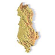
![]()
- File size: 280 MB
- Model size: 218 mm x 173 mm x 1.0 mm
- Projection: Equidistant Conic
- Scaling factor: X — 0,001; Y — 0,001; Z — 0,005
- Polygons: 5 887 734
- Vertices: 2 944 516
- Geometry: Polygonal Tris only
- Base: Closed
Asia Topographic Map STL – High-Detail 3D Terrain Model of Asia
Asia topographic map STL is a high-resolution 3D terrain model of the Asian continent, designed for 3D printing, CNC carving, laser engraving, and relief map production. This digital STL file accurately represents the relief and large-scale geography of Asia, making it ideal for professional, educational, and creative applications.
The model is delivered as a closed, watertight STL, fully prepared for fabrication workflows including FDM, SLA, CNC milling, and laser cutting.
Precision 3D Terrain Model of Asia
This Asia 3D map STL is based on a consistent cartographic projection (Equidistant Conic) and optimized elevation scaling to clearly express mountains, plateaus, and continental relief. With nearly 6 million polygons, the terrain preserves fine details while remaining stable for slicing and machining.
Perfect for 3D Printing, CNC & Laser Projects
The Asia terrain STL file is suitable for:
- 3D printed relief maps (plastic, resin, composite)
- CNC carving in wood, MDF, aluminum, and metal
- Laser-engraved relief panels
- Wooden 3D maps and wall art
- Educational and exhibition models
You can easily adjust the scale, base height, or overall dimensions in any STL-compatible software (Blender, Fusion 360, Meshmixer, etc.).
Professional Use & Digital Applications
Beyond fabrication, this 3D model of Asia can be used for:
- Geographic visualization and presentations
- Architecture and urban planning concepts
- Museum and academic displays
- Master molds for casting and duplication
The STL format ensures compatibility with all major 3D modeling and slicing software.


Customization Available
If you need this Asia topographic model in a different size, resolution, elevation exaggeration, or map projection, custom versions can be produced on request.