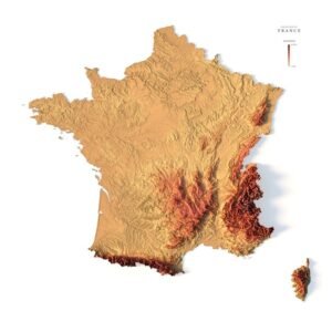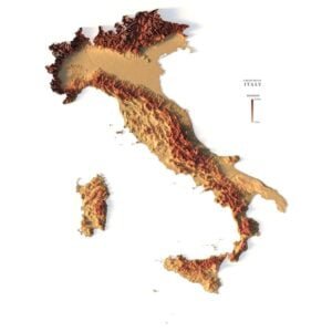
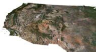
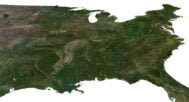
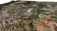
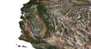
United States 3D Model Terrain
$35.00
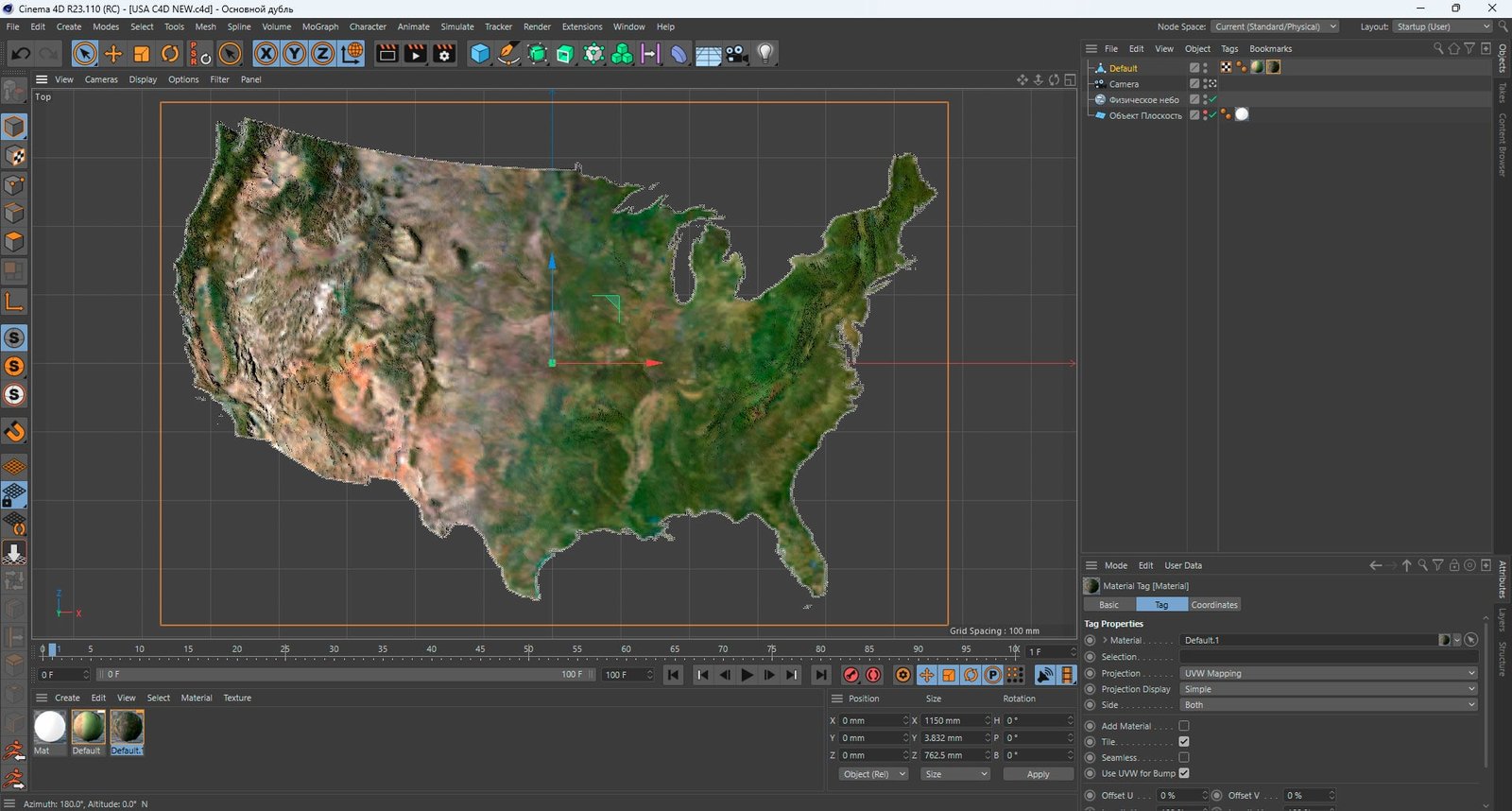
![]()
3D model
- Format: C4D (export to OBJ/FBX on request)
- File size (unzipped): 571 MB
- Polygons: 9 986 310
- Vertices: 4 997 720
- Geometry: Polygonal Tris only
- Model size: 1150 mm x 762.5 mm x 3.832 mm
- Projection: Lambert Conformal Conic
- Base: Open
- UV layer: Yes (frontal)
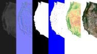
Textures
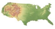
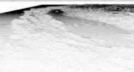
- Height Map TIF 8193*5432*16b – You can use this map in the displacement channel instead of the polygonal mesh.
- Normal Map TIF 8193*5432*48b – Use this map to reveal fine details of the relief.
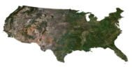
- Satellite Map TIF 9202*6101*48b.
- Water Mask TIF 9202*6101*48b – Use this map for masking in the Reflection channel to get glare from the water surface.
- Pseudo-color Map 9202*6101*48b – Use this map to get elevation information based on the color shade.
- Boundary Mask TIF 9202*6101*48b – Use this map as a mask for your background.
Other models can be made on request.
Modifications, more detailed models and better textures on request.
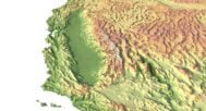
3D Model of the USA Terrain for Creative and Educational Projects
Introducing the United States 3D Model Terrain, designed for graphic design, educational projects, and creative tasks. This highly detailed model accurately represents the terrain of the USA, making it perfect for visualizing landscapes of the United States in various fields.
Model Features
Our 3D terrain model of the United States includes several high-resolution elements:
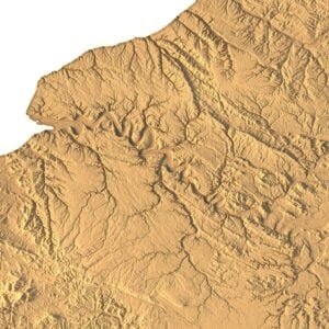
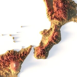
- Digital Elevation Model (DEM): Captures precise height variations for use in geographic and architectural visualizations.
- Normal Map: Enhances texture realism, adding depth and detail.
- Satellite Texture: Provides a true-to-life representation of the landscape, ideal for design and educational use.
- Masking Maps: For rivers, lakes, and contour boundaries, ensuring precise terrain visualization.
- UV Layer: Ensures accurate texture placement on the mesh.
Applications of the Model
This 3D model of the terrain of the United States is perfectly suited for projects where accurate terrain visualization in the USA is crucial. It can be used for:
- 3D visualizations and animations
- Educational and cartographic projects
- Architectural and geographical studies
Benefits of Our USA 3D Terrain Model
- High level of detail for accurate visualizations
- Ready-to-use textures, saving time in design processes
- Easy integration with 3D modeling software
- Versatile use across multiple industries
Why Choose Our Terrain Model?
We offer a detailed United States terrain model that includes ready-to-use textures and maps, making it easier to integrate into your projects. Whether you’re a designer, educator, or researcher, our model will help visualize the terrain in the USA with precision.
In addition to the 3D terrain of the United States, you get a map of heights, a map of normals, satellite textures and other maps.
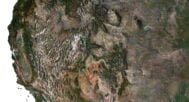
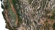
Height Map

You can use this map in the displacement channel instead of the polygonal mesh.
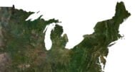
Normal Map

Use this map to reveal fine details of the relief.
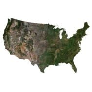
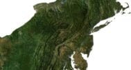
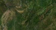
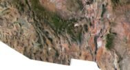
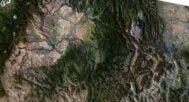
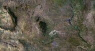
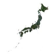
Satellite image

The satellite texture is high resolution in TIF format.
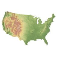
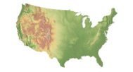
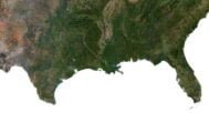
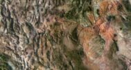
Pseudo-color Map

Use this map to get elevation information based on the color shade.
Water Mask

Use this map for masking in the Reflection channel to get glare from the water surface.
FAQ
Yes, we offer custom projections upon request. Contact us for details.
The model can be exported in multiple formats such as OBJ, FBX, and STL, ensuring compatibility with most 3D software.
Yes, we can optimize the model by reducing the number of polygons, tailoring it to your project's performance needs and budget.
For custom sizes or additional features, please contact us directly. We are happy to work with you to create a tailored map that fits your specific needs.
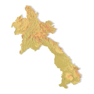
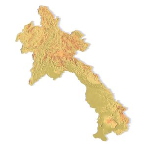
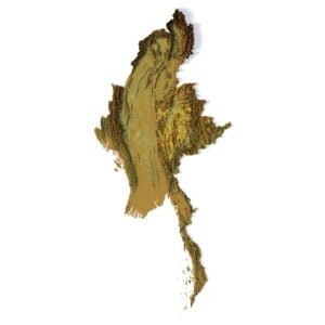
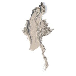
Related products