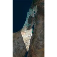


Israel Satellite Map
$15.00
Buy Israel Satellite Map – Ideal for Education, Decor, and Gifts
- Format: TIF
- Resolution: 8674*15517 px
- Depth: 24 bit
- Size: 138.4 MB
- Color scheme: RGB
- Projection: Mercator
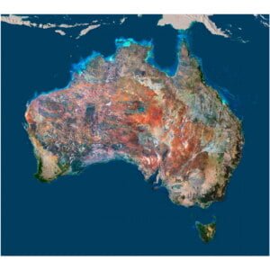
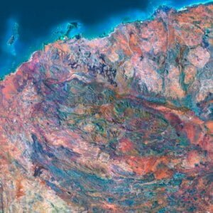
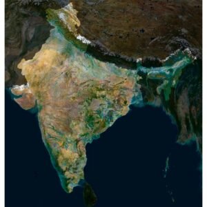
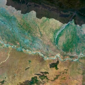
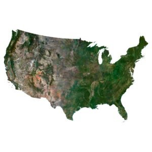
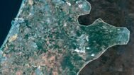
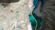
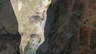
The Israel Satellite Map offers a stunning, high-resolution view of the country’s diverse landscapes, captured through detailed satellite imagery. This Israel aerial map TIF provides exceptional clarity, making it perfect for education, interior decor, and professional projects.
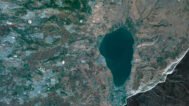
Covering the Mediterranean coastline, Judean Hills, Negev Desert, and the Dead Sea basin, this printable Israel satellite image shows every geographic feature in precise detail. Whether you are a teacher, designer, cartographer, or traveler, this map delivers both beauty and accuracy.
Key Features:
✔ High Resolution– crystal-clear image quality.
✔ Printable Israel Satellite Map: Large-format printing without loss of quality.
✔ Israel Aerial Map TIF: Fully compatible with professional design software.
✔ Educational Resource: Perfect for teaching Israel’s geography and landscapes.
✔ Decor & Gifts: Ideal for framing, wall art, and geography-themed presents.
Example Uses:
Create a large wall poster with Israel’s satellite view for office or home.
Integrate into geography lessons to teach terrain, land use, and climate zones.
Use in tourism brochures or travel presentations.
Frame as decorative wall art with a modern geographic theme.
FAQ
This map is not geo-referenced, but feel free to contact us to obtain a file with geo data if needed.
Yes, we offer custom projections upon request. Contact us for details.
Yes, if you need the map in a different file format, please contact us. We offer various formats to meet your needs.
Yes, of course. Please specify the desired 3D model format, dimensions and how you will use it. This will help me to prepare an optimal model for you.
Absolutely! If you require a higher resolution version, just let us know, and we can provide a version that fits your requirements.
Yes, we can customize the map with different projections or remove boundaries as needed. Please reach out to us with your specifications, and we’ll accommodate your request.
For custom sizes or additional features, please contact us directly. We are happy to work with you to create a tailored map that fits your specific needs.
Absolutely! The map is available in high resolution, making it suitable for large format printing without losing detail. Be sure to check with your printing company if they require RGB-to-CMYK color conversion for best results.
In addition to educational and decorative uses, the map can be utilized for trip planning, natural resource research, and as a creative gift.