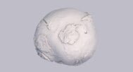

Geoid Height STL Model – Artistic Earth Gravity Surface for 3D Printing
$21.00
![]()
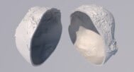
3D Model
- Format: STL two-piece hollow and STL thin-walled
- File size (unzipped): 94 MB
- Polygons: 1 966 080
- Vertices: 983 042
- Geometry: Triangular polygons only
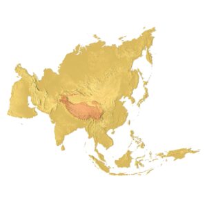
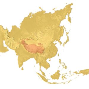
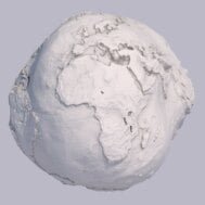
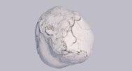
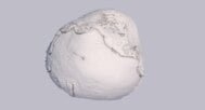
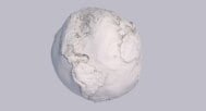
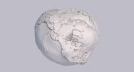
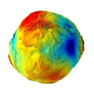
Geoid Height STL Model is an artistic three-dimensional interpretation of the Earth’s gravity-defined shape, created for visual exploration, decorative 3D printing, and conceptual education. Unlike scientific geoid datasets used in geodesy, this model intentionally exaggerates gravity-induced height variations to transform an invisible physical phenomenon into a striking physical object.
Artistic Geoid Surface Inspired by Earth’s Gravity
The Earth’s surface is not as smooth as idealized ellipsoidal models suggest. Variations in the planet’s internal density cause gravitational forces to pull and push the surface unevenly, resulting in a shape that resembles an irregular, potato-like form rather than a perfect sphere.
Models approximating this gravity-driven surface are known as geoids. The geoid represents the theoretical mean sea level, assuming the absence of tides, winds, and ocean currents, with gravity being the only defining force.
Exaggerated Relief for Visual Expression
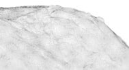
In reality, Earth’s gravity field variations are extremely subtle. Without vertical exaggeration, these differences would be nearly invisible. For this reason, the height variations in this geoid STL model are exaggerated many times over for visual clarity and artistic impact.
Additionally, the continental regions are artificially raised to enhance contrast and create a more expressive, sculptural form.

Important Disclaimer
This geoid height STL model is not intended for scientific, geodetic, or analytical use. It is a conceptual art model, inspired by geophysical ideas but deliberately modified for aesthetic purposes.
Applications
- Decorative 3D prints
- Art installations and exhibitions
- Conceptual geography education
- Design objects and visual studies
Key Features
- Artistic interpretation of Earth’s geoid
- Strongly exaggerated gravity relief
- Raised continents for visual appeal
- Optimized STL geometry for 3D printing
- Two-piece hollow and thin-walled STL versions