– Top View")


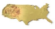

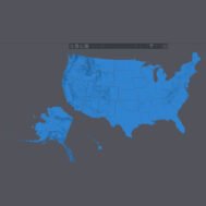
USA 48 States Topographic Map – 3D Model for 3D Printing & CNC Carving
$25.00
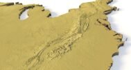
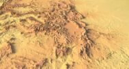
High-Quality Topographic Map for 3D Printing and CNC Carving
![]()
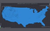
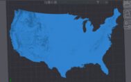
3D model:
- File size: 155 MB
- Model size: 166.517 mm x 218 mm x 3 mm
- Projection: Lambert conformal conic
- Scaling factor: X — 1; Y — 1; Z — 6
- Polygons: 3 258 785
- Vertices: 1 630 530
- Geometry: Polygonal Tris only
- Base: Closed
Description
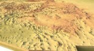
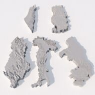
Experience the beauty and precision of the USA 48 States Topographic Map with this highly detailed 3D model. Perfect for 3D printing (FDM & SLA) and CNC carving, this relief model provides an accurate terrain visualization of the continental United States.
Why Choose This Topographic 3D Model?
🌍 Accurate Geographical Representation
This model is based on real-world landform features, ensuring an authentic depiction of state boundaries, mountains, valleys, and plains. It serves as an ideal educational tool for students, researchers, and geography enthusiasts.
🖨️ Designed for 3D Printing & CNC Carving
- Optimized for FDM & SLA 3D printing
- Compatible with CNC carving for wood, plastic, and other materials
- High-resolution terrain details for professional and personal use
🎓 Perfect for Learning & Display
- Ideal for educational purposes in geography and cartography
- A great addition to home, office, or classroom displays
- Suitable for DIY projects and creative applications
Have a Question?
Do you need an extra high resolution 3D terrain of United States?
Do you need Shapefile?
Do you need more resolution satellite images?
Do you need a 3D model in BLEND, OBJ or FBX format?
Do you need Shapefile?
Do you need more resolution satellite images?
Do you need a 3D model in BLEND, OBJ or FBX format?