Blog
Elevation Modeling – which to choose DTM, DSM or DEM?
Differences Between DTM, DSM and DEM for 3D Terrain Modeling
Digital terrain models (DTM), digital surface models (DSM), and digital elevation models (DEM) are integral components of modern geospatial technology used to represent and analyze terrain features in a three-dimensional space. This paper explores the fundamental differences between DTM, DSM, and DEM, highlighting their distinct characteristics and applications in various manufacturing technologies.
DEM – Digital Elevation Model
DSM – Digital Surface Model
DTM – Digital Terrain Model
1. INTRODUCTION
Accurate representation of terrain is essential for a wide range of applications, including urban planning, environmental analysis, disaster management, and manufacturing processes like 3D printing and CNC milling. DTM, DSM, and DEM are three distinct digital models used to capture the intricate details of terrain features.
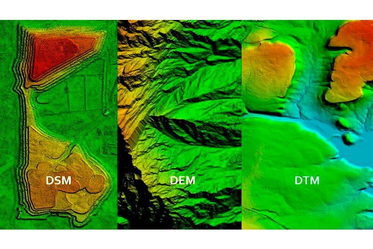
2. DIGITAL ELEVATION MODEL (DEM)
A Digital Elevation Model (DEM) is a digital representation of the elevation of the bare ground relative to a reference surface or vertical datum. Each cell or pixel in a DEM corresponds to a specific elevation value above the bare ground. DEMs are typically represented as regular grids of elevation points. These models are fundamental in capturing the topography of the terrain, enabling accurate visualization and analysis of surface features. However, DEMs alone may lack certain elements, such as natural features like rivers and ridge lines, which are crucial for comprehensive terrain representation.
3. DIGITAL TERRAIN MODEL (DTM)
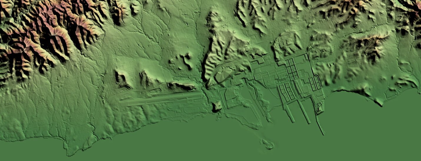
A Digital Terrain Model (DTM) goes beyond the basic elevation representation of a DEM. It encompasses a comprehensive 3D representation of the terrain surface, utilizing X, Y, and Z coordinates stored digitally. In addition to elevation information, a DTM incorporates various geographical elements and natural features, including rivers and ridge lines. The key differentiator between a DTM and a DEM is the augmentation of the terrain data. This augmentation involves the incorporation of break lines and supplementary observations to correct artifacts present in the original data. Therefore, a DTM is a refined and enhanced version of a DEM, providing a more accurate representation of the terrain’s surface characteristics.
4. DIGITAL SURFACE MODEL (DSM)
A Digital Surface Model (DSM) focuses on capturing the elevations of reflective surfaces, including vegetation, buildings, and other features, above the “Bare Earth.” Unlike DEMs and DTMs, DSMs do not exclusively represent the bare ground elevation. Instead, DSMs provide a representation of the highest point of each object present on the terrain, including structures that may not be directly attached to the ground. This makes DSMs valuable for applications such as urban planning, where the heights of buildings and vegetation are essential for designing infrastructure and analyzing line-of-sight visibility.
5. APPLICATIONS IN MANUFACTURING PROCESSES
DEM and DTM, DSM are the basis for creating 3D Terrain Models, which in turn are used to:
- Graphic Design: DEM, DTM, and DSM data are crucial in graphic design for creating visually appealing and realistic 3D Models and 3D maps and renderings. By incorporating accurate elevation data, graphic designers can produce maps that accurately depict the topography of a region, enhancing the realism and detail of their visualizations.
- 3D Printing: 3D printing technology allows the physical manifestation of digital data. Using DEMs, individuals and organizations can create physical models of various geographic features, ranging from small islands to entire continents. By converting elevation data into 3D-printable files, one can generate tactile and visually informative models for educational, decorative, or research purposes.
- CNC Milling: CNC milling is a manufacturing process that uses computer-controlled machines to cut or mill materials such as wood, plastic, or metal, giving them specific shapes. The DEM data can be used to create 3D models and control programs that direct the CNC machine to create physical models that accurately represent the Earth’s surface, including both the natural topography and any structures or features present in the DEM.

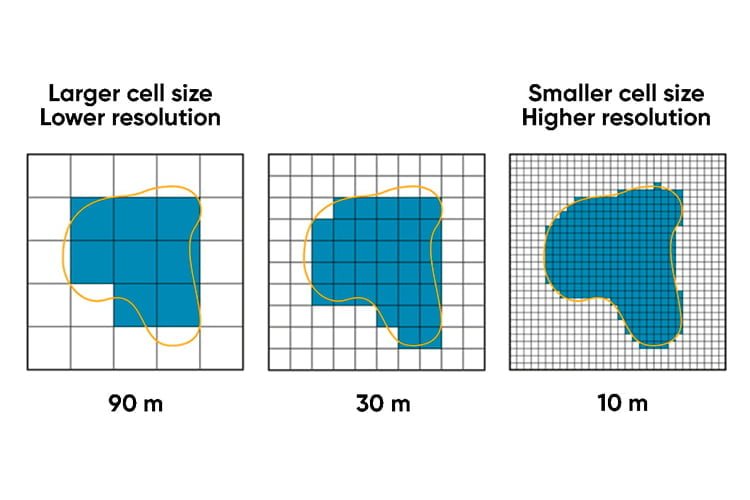
The quality of the final products depends on the technologies, materials and tools used, as well as on the quality of 3D models. The quality of 3D models, in turn, depends on the spatial resolution of DEM/DTM/DSM.